Getting There: At Superior, take Diamond Road east past the Town Pump Gas Station for 6 miles; passing the Bark mill and the Magone Ranches to the end of the pavement where the road changes to Trout Creek Road (#250). Continue up Trout Creek Road (~19 miles) until you top out on Hoodoo Pass on the Idaho / Montana border.
 Continue on Road #250 into Idaho for about 11 miles. About a tenth (0.1) of a mile before crossing the Middle Fork of the Clearwater River, road #250 crosses Long Creek and stays left of the Clearwater River. If you cross the river and get to the Cedars Campground, you have gone too far. Stay on road #250 for another half (.5) mile then stay left on road #295 up Lake Creek for about 4.5 miles. There will be a picnic area / trailhead with a vault toilet at the intersection.
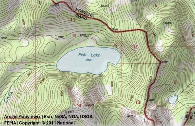
The left fork (road #5450) goes for a mile to a gate and the trailhead to Goose Lake and Steep Lakes; the right fork continues up Lake Creek for 1.5 miles to the trailhead for Fish Lake. Road #295 becomes trail #419 at that point; okay it is a road. Stay on this well-defined route for 6 miles to Fish Lake, the largest lake in the Great Burn area. Trail #419 moderately climbs up the valley crossing two creeks (Siam & Japanese) and several other small creeks with just the middle couple miles a bit steeper, so it is easy to make good time. Once you cross the 350+ foot boardwalk you are about 1/2 mile from the lake.
Getting There: Take the Fish Creek Exit on I-90 and proceed up Fish Creek Road #343, then the right fork on road #7750 (Iowa State Research Center) that ends at the Clearwater Crossing in 6.75 miles. The clearwater crossing has a small campground (3 sites), 2 vault toilets and a Forest Service Guard Station. Cross the West Fork of Fish Creek on the stock bridge to pick up trail #101. Follow trail #101 for 9.25 miles to Foley Basin where trail #114 to the Lower Siamese intersects.
 Along the way you cross the West Fork at mile 3 where you intersect trail #110 coming out of Cedar Log Creek and a camp site and swimming hole is just 100 yards from the crossing. The bridge is old, it has been there in excess of 50 years as I remember it back then; nowadays a single hiker can make the bridge flex by just walking across so it might be gone in a few years. I believe the bridge is scheduled to be replaced in 2026.
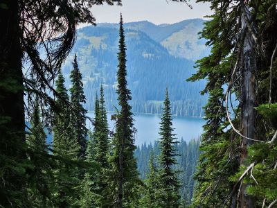
At five miles the trail (#121) out of Indian Creek crosses the West Fork and connects with trail #101. The trail continues up the valley to Foley Basin at a moderate grade with a steeper grade around the couple switchbacks after passing by the creek coming out of the Siamese Lakes. At Foley Basin the left fork (#101) climbs moderately up to the state line and Fish Lake in a little more than a mile. The right fork is trail #114 to the Lower Siamese Lake. Once at the stateline, continue down the hill for another 1/3 of a mile to the lake, a grand total of 11 miles.
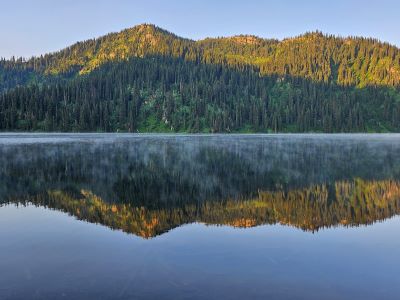
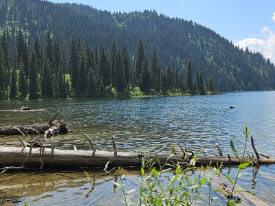
At the Lake: Fish Lake is the largest of the lakes included in these descriptions; a float plane could probably land and take off. There are multiple campsites (6+) around the north shoreline and the east end of the lake and three outhouses, with multiple improvements like stairs to the lake and boardwalks to cross sensitive areas due to the motorized traffic allowed into the lake. Prior to 2024, I never camped or fished (cutthroats) at the lake, just passed by on the way to or from the Siamese Lakes and I previously (pre-2024) never took any pictures at the lake even though I have walked right by it several times. In 1986 I biked, hiked & skied over Memorial Weekend to the stateline above Fish Lake, but didn't go down to the lake.