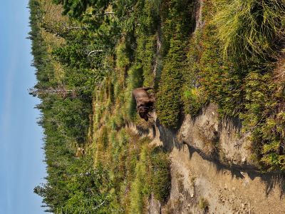
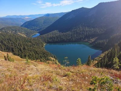
What to Expect: This 10.0 mile section of Stateline Trail #738 is mostly a dry hike with just 1 reliable water source around the halfway mark outside of snowbanks during early summer. There is a small tarn (in MT) on the south slope of Eagle Cliff Peak that is 400 below the trail and a stream in a basin (in ID) near the Dry Creek Trail #151 intersection that is 300 feet off the trail. 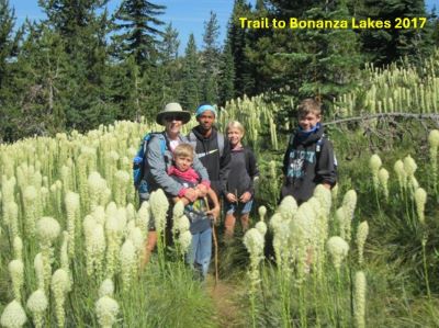 Both would be difficult to get to, but both have game trails that get close. The trail doesn't have any super steep sections but there are several long (1 mile plus) moderate climbs across the distance. There are a number of great overlooks that are either just off the main trail or a short distance up a ridge to a peak or high point. On a clear day views are outstanding all around with the Mission Mountains visible to the North. Mountain Goats inhabit the cliffs above Cliff Lake and near Eagle Cliff Peak, so keep an eye out. There are 10 lakes along the divide; Cliff, Diamond, Feather (ID), Hidden, Heart, Frog (ID), Lost, Bonanza's and Missoula of which Missoula, Bonanza's & Frog are the only lakes that I would consider viable overnight options as they are the only accessible by trail from the stateline.
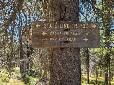
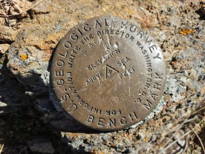
Getting There - Dry Creek Summit Trailhead: Take the Dry Creek Road exit off I-90, about 5 miles West of Superior. Cross the railroad tracks on the Southside Highway (#69); after about 3/4 mile, hang a right on Dry Creek Road #342. After about 8 miles there will be a large pull out to your left and a prominent sign for the Dry Creek Trail #151. Continue up Dry Creek Road #342 staying right at the fork to Diamond and Cliff Lakes to the Idaho / Montana state line, an additional 10 miles. The road is good the entire way to the trailhead. There is a year-round water source about 1/3 mile before the trailhead along the Dry Creek Road in the ditch if needed.
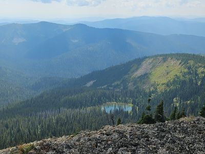
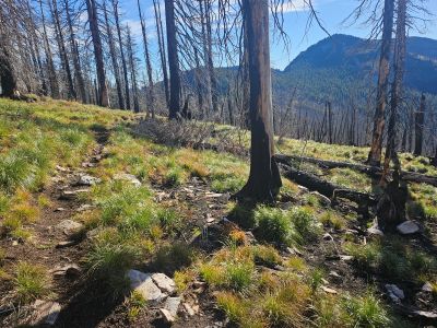
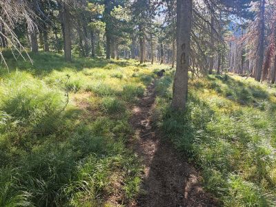
Trail #738 Description North to South: The trail takes off sharply to the left between the main and a gated road to the left just as you reach the state line; I believe there is a trail marker of some kind. There has been some logging operations in the past in this area. The trail starts out very mellow but soon begins to steadily climb for the next mile. You will pass signed intersections for USFS trails #203 to Torino Peak & main Dry Creek Road on the Montana side; and trail #290 on the Idaho side. The trail flattens out a bit with some short rollers for the next 3/4 mile, passing through a wildfire burn. This will take you to the first good overlook of Cliff and Diamond Lakes, a good place to take a break.
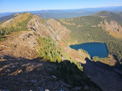
 From that first overlook, the trail will quickly start climbing around the lower shoulder of Eagle Cliff Peak for 1/2 mile to the next good overlook of the same lakes on top of the stateline. Continue around the right shoulder of Eagle Cliff Peak until you meet up with ridge again with a good view of a couple small tarns below and the main Dry Creek drainage spread out in the distance. It is a relatively short walk, less than 150 feet of elevation, back up the ridge to the summit of Eagle Cliff Peak and its outstanding vistas. Well worth the extra effort.
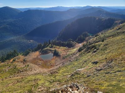
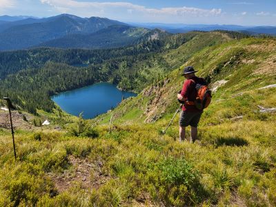
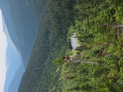
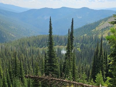
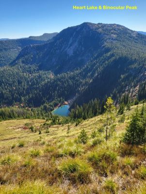
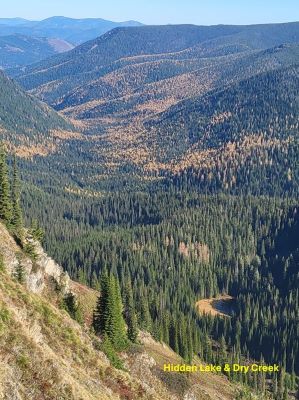
From this point the trail mostly descends through another old fire, staying on or near the ridgeline with very good views of the main Dry Creek drainage and Hidden Lake. You briefly climb back up to 7,000 feet before descending to the intersection of Dry Creek Trail #151 and USFS Trail #77, this is 4.5 miles into the hike. This is also a good vantage point to view Heart Lake of Dry Creek.
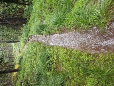
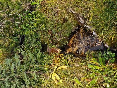
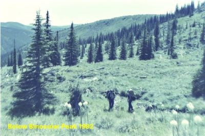
The stateline trail then descends further down to a low saddle directly above Heart Lake and sidehills down around Binocular Peak and past Frog Lake to 6,400 feet and the only reliable and easily accessible water source between Dry Creek and Cascade Pass on the southern shoulder of Binocular Peak for a total of almost 6.0 miles. This appears to be a year-round water source as I have been by it after Labor Day, and it still has plenty of flow. There are a couple other small seeps and streams in the next 0.5 mile but they are dry late in the summer.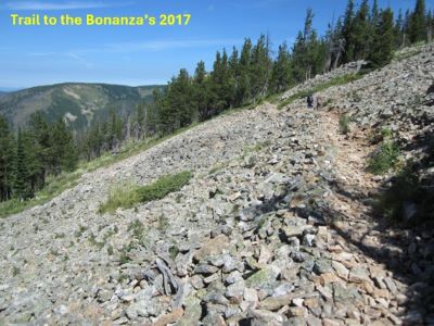 The small stream is the starting point for a primitive trail to Frog Lake. If planning a night at Frog Lake, it would be best to get all the water for the night here. There is a good campsite by Frog Lake's outlet, but water tends to look a bit stagnate and stale, plus there are a gazillion frogs in the lake. Shortly after the stream, the trail starts climbing moderately for about 1.25 miles back to the stateline at 7,000 feet and the first overlook to the Bonanza Lakes. Along the way as you climb a short steep section look for an unsigned trail on the left that will take you to a saddle with views of Lost Lake, Lost Peak and the Lost Creek Drainage. From that intersection the trail climbs moderately for a bit more than 1/2 mile to an overlook above the Upper Bonanza Lake with the Lower Bonanza Lake in the distance. A short hike up and left on the ridge will get you to another good vista point with outstanding views of the Bonanza Lakes, Lost Lake & the Lost Creek drainage; and looking South along the stateline.
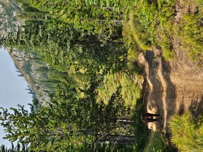
Back on the main stateline trail, it descends for the next 1.3 miles down the ridge with good views all around until intersecting with trail #616 coming out of the Bonanza Lakes. It is about a mile down trail #616 to the lower Bonanza Lake. The stateline trail continues level or gently downhill for 1.5 miles to Cascade Pass. If hiking through and needing water there is a good stream about 1/2 mile down the road on the Montana side. There is also a small non-fee USFS campground with a vault toilet but no water just down the road. A trail (old main road) just below the main road will take you to the campground from Cascade Pass.
Getting There - Cascade Pass (Missoula Lake Saddle): From Superior, take Cedar Creek Road #320 and head toward Missoula Lake and Cascade Pass, a distance of 25 miles; stay on the main road as there are several other roads that connect. Stay left and cross the bridge near the 6 mile mark, the right fork is the Lost Creek road. At mile 12 you will cross a small bridge and then intersect a main logging road coming out of Rabbit Creek, stay straight. Another 1.5 miles will bring you to the intersection with road #388 (left) which will take you to the Gildersleeve Mine, Freezeout Pass and eventually Trout Creek Road #250. The intersection is signed, stay straight and go up the hill. After a series of steep switchbacks, the road tops out on Miller Saddle and begins a descent for the next couple miles with some good views of the stateline.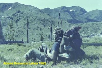 After coming off Miller Saddle, (about 20 mi) there will be an intersection at the bottom of the drainage. Stay straight crossing Oregon Creek. The right fork at this intersection (road #7763) heads down the hill to the Big Flat; the left fork will take you up to the Oregon Lakes trailhead (1/2 mi). At mile 24 the road over to Missoula Lake Campground and it's trailheads takes off down and right, stay straight and in another mile you will top out on Cascade Pass. There has been quite a bit of logging up the Cedar Creek drainage for several years and looks to continue into the future. At times, there is a large lighted sign at the end of the pavement indicating hauling, so don't assume you are the only one on the road.
Trail #738 Description South to North: Stateline trail #738 is just across the road from the Cascade Pass sign. The 4-wheeler tract that heads straight up the hill is not it. Head north on this easy and mostly level trail for about 1.5 miles to a low saddle. There, trail (#616) heads down into the head of Cataract Gulch and over to the Bonanza Lakes. Continue straight on trail #738. The trail continues mostly uphill for another 1.3 miles with several overlooks to both Bonanza Lakes and surrounding drainages. At the last overlook of the Bonanaza's before the trail starts downhill, you can hike up the ridgeline to the right where a nice overlook presents a 360 view of the area.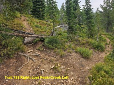 The trail then turns downhill for an additional 1.25 miles, passing the primitive trail to Lost Peak, to a small stream crossing for a total of 4 miles. The unmarked trail to Frog Lake is straight ahead at the crossing, while the state line trail #738 abruptly starts to climb to the right after the stream crossing. This small stream is the only reliable and easily accessible water between Cascade Pass and the Dry Creek Summit.
 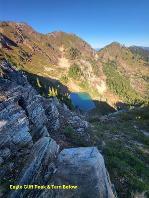 I have been past this stream after Labor Day and it is still running with good flow. There some other small seeps on the trail but they are dry late in the summer. If staying at Frog Lake, it would be best to collect enough water for the night at the stream as Frog Lake can be a bit stagnant and contains thousands of frogs.
It is a mile long climb around the shoulder of Binocular Peak until the trail levels off near the saddle above Heart Lake of Dry Creek. The trail climbs to the intersection of Dry Creek Trail #151 and USFS Trail #77 into Idaho. A short walk on #151 will get you to a good overlook of Heart Lake, Binocular Peak and the Dry Creek Drainage. The trail continues uphill through an old fire to almost 7,000 feet before providing a bit of a downhill break but then climbs back to 7,400 as you reach Eagle Cliff Peak, 3 miles from the small stream at 6,400 feet.
There are several great overlooks of the Dry Creek drainage, Hidden Lake and several tarns along the way; and just a short climb of less than 150 feet to the summit of Eagle Cliff Peak. The rest of the way (3 mi) to the Dry Creek Summit is mostly downhill passing several good overlooks of Cliff and Diamond Lakes; and signed intersections for USFS trails #203 to Torino Peak & main Dry Creek Road on the Montana side and trail #290 on the Idaho side. This is the end of the single track of Trail #738. The trail becomes the stateline road #391 which continues all the way to the Roland Summit above the Hiawatha bike trail near Lookout Pass. It is drivable the entire distance but is rocky, narrow and rough in several sections past the Little Joe Road pass.