Getting There: At Superior, take Diamond Road east past the Town Pump Gas Station for 6 miles; passing the Bark mill and the Magone Ranches to the end of the pavement where the road changes to Trout Creek Road (#250). Continue up Trout Creek Road (~19 miles) until you top out on Hoodoo Pass on the Idaho/Montana border. Continue on Road #250 into Idaho for about 11 miles. About a tenth (0.1) of a mile before crossing the Middle Fork of the Clearwater River, road #250 crosses Long Creek and stays left of the Clearwater River. If you cross the river and get to the Cedars Campground, you have gone too far. Stay on road #250 for another half (.5) mile then stay left on road #295 up Lake Creek for about 4.5 miles. There will be a picnic area / trailhead with a vault toilet at the intersection. The left fork (road #5450) goes for a mile to a gate and the trailhead to Goose Lake and Steep Lakes; the right fork continues up Lake Creek for 1.5 miles to the trailhead for Fish Lake. Road #295 becomes trail #419 at that point, well it is still a road that can be driven by 4x4’s, motorcycles and E-bikes (motorized vehicle) to Fish Lake; although I think it is limited to a max of 50 inches wide.
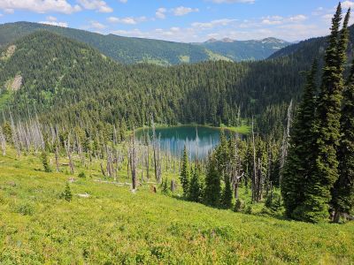
 Stay on this well-defined trail/road for 6 miles to Fish Lake, the largest lake in the Great Burn area. Trail #419 moderately climbs up the valley crossing two creeks (Siam & Japanese) along with several small springs, with just the middle couple miles a bit steeper, so it is easy to make good time. When you reach the 350+ foot boardwalk, you will be less than a mile from Fish Lake.
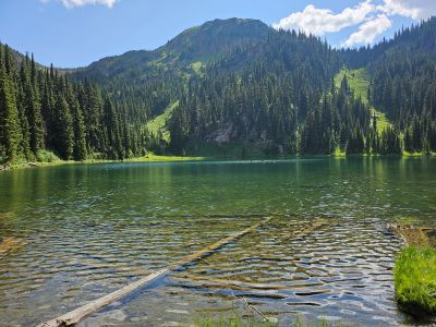
At Fish Lake the stateline trail #738 comes down to Fish Lake near the 2nd outhouse, follows the lake shore around to the east end on the 4x4 road for 1/2 mile and then leaves the road to climb back up to the stateline. There is a sign at this junction with (was) a log across the trail to somewhat block illegal motorized use.  The good trail climbs moderately to a saddle where the right fork (Trail #490, Bruin Hill) heads straight, with the left fork heading east up the ridge to another saddle before dropping into the basin containing Vann Lake; there are signs near the junction.
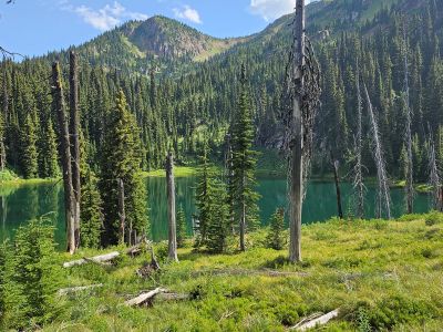
After you leave the second saddle and head down the hill, look for a nice overlook that provides a good view of Vann Lake and the backside of Admiral Peak. The trail down to the lake is in good shape as it switchbacks down thru an old burn. The Montana Fish & Wildlife sometimes refers to Vann Lake as W Fork Fish Creek Lake 1, I prefer Vann Lake.
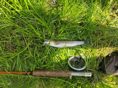
At the Lake: Prior to 2024, I had only passed by Vann Lake a couple of times eating lunch and getting water. There is a nice flat campsite near the outlet that is not used regularly. There are Cutthroat Trout (10+ inches) in the lake and it is planted every 5-7 years. The shoreline has very good access and is not too brushy. If you don’t want to camp at Fish Lake, this may be a good alternative for some quiet time and solitude away from the motorized traffic. It is not a bad 2-mile hike over from the Fish Lake side.
If you are coming from the Clearwater Crossing up the West Fork of Fish Creek it is a 13-mile trek on a good trail the entire way; and it's a rugged and sometimes rocky 8.5 miles from the Schley Mountain trailhead.