
Getting There: Take the Fish Creek Exit on I-90 and proceed up Fish Creek Road #343, for approximately 16 miles and turn right on Surveyor Creek Road #7734 for 12 miles to the Schley Mountain Trailhead. This is a rough 12 miles, especially the portion past the Surveyor Lake trailhead at 8.5 miles. The Schley Mountain Trailhead has several places to camp and park along with a vault toilet. This trailhead and campground are dry, so bring plenty of water if camping. This is not the actual end of the road. The gate is only open from when the snow is off until August 31; the gate is not open over Labor Day weekend.
 The road behind the gate is designated by the Forest Service as a non-maintained road. The Forest Service does not maintain or brush out this road. If you are the first one through the gate in the summer, then expect to saw out the downed trees from the winter storms if you want to drive the 3 miles to the end of the road and the old trailhead. The road is pretty good until you reach the 2 switchbacks, and the road gets decidedly worse from there for the last mile. Pullouts are a bit scarce so someone may have to back up a way when meeting another vehicle. The trailhead has plenty of room for parking and several camping sites; the ridge trail from Schley Mountain connects back to the road. The road continues beyond the gate.
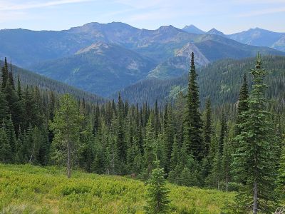
 Hike this road, bearing left and up after 1/3 mile, the stateline and trail number #738 is about 1 mile from the trailhead. Once on the stateline stay on the main road / trail that heads north with great views of the Kelly Creek drainage with Shale Mountain and Rhodes Peak in the background. The road / trail will split again at the 2-mile mark with the right fork continuing to the South (Big) Cedar Log Lake and the left down to Kid Lake.
Head down to Kid Lake, cross the outlet where the main Kelly Creek Trail #567 connects and continues up the hill past Kid Lake. The trail winds uphill from Kid Lake to the stateline. This is a rough and rocky trail that culminates with a steep pitch for the last couple hundred feet to the saddle and stateline. Once on the stateline follow the ridge West from the saddle towards the rocky knob. The stateline trail #738 continues North down the hill towards Mud Lake, which is visible from this saddle. The ridgeline west of the stateline is rough with no trail. Sometimes it is best to stay to the right of the crest as you work your way to the low saddle before making the climb up to the knob. An alternate route is to leave the stateline trail just you start the last steep climb to the stateline and angle over to the low saddle below the rocky knob. I did this route in 2025, but I am not sure if it is any better as it is also cross-country venture with no trail. But it is a doable option.
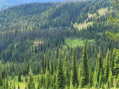
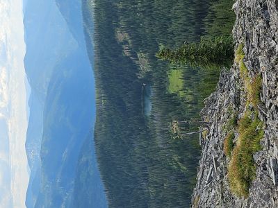
 As you start climbing this knob, look for a game trail that heads straight up the ridge for a bit. After that trail fades out, angle to the shoulder of the ridge below the rocks. Take the time to walk up to the top of the rock pile as the views are very good. Once on the ridge, Kelly Lake is visible along with the large meadow just above the lake. Head towards the lake between the 2 rocky areas and make your way by the best route you can find. I found that the slope down to the lake is not very brushy with lots of open areas available to get to the lake, so the going is very good for a cross-country route.
There are 2 small stream beds that were dry when I passed through in mid-July, so no water after the small spring above Kid Lake or an occasional snowbank. It is about 1.25 miles from where you leave the stateline trail. Double the time that you took to get from the ridge to the lake on the trip back as it is nearly a 1,000-foot climb out.
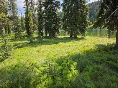
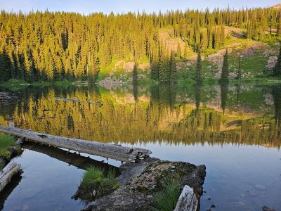
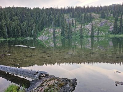
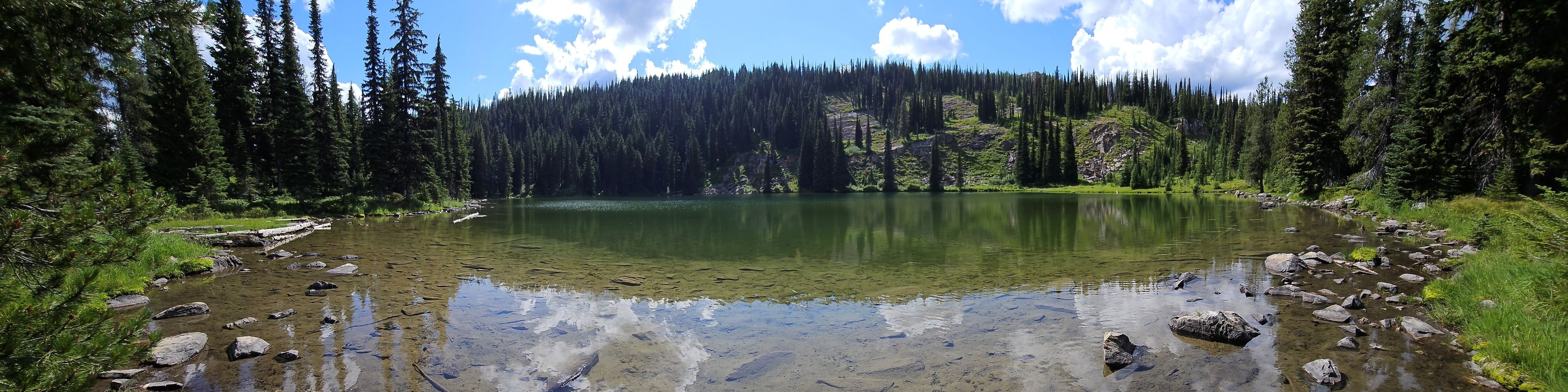
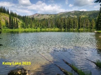
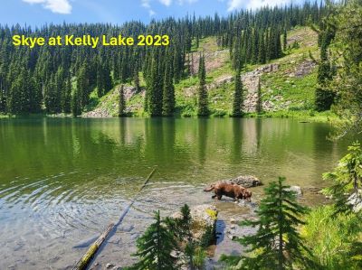
At the Lake: Kelly Lake is a smaller sized lake that is shallow on the Eastern shore, but deeper on the South and Western shorelines. This appears to be a barren lake as I didn’t see any evidence of fish nor had any bites for the time I fished in 2023. The Idaho Fish & Game site shows that the lake was stocked many years ago but hasn’t been for several decades. I was pleasantly surprised to find a good trail around the eastern shore, although I never found any existing campsites.
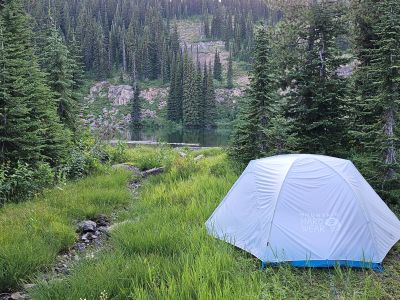
The eastern shore and immediate area are flat and grassy, kind of a park-like atmosphere. That being said it is all bear grass and low shrubs, not the best to sleep on. The only good camping sites that I found were over by the outlet. There is a good site for 1 tent right next to the outlet streambed and another just back in the trees to the right of the that site; although is has some rock. The site by the outlet where I pitched my tent is also right on the game trail around the lake so I had a couple visitors that stomped and snorted in protest during the night.
If a group or person wanted to have a bit of an adventure with some off-trail trekking, some different views and get away from the rest of the world this lake would be a great fit as long as fishing wasn’t a priority. Sunrise is very nice as the lake faces to the east. It is a bit of a slog on the way out (almost 1,000 ft) but take your time and water up.