
Getting There: Take the Fish Creek Exit on I-90 and proceed up Fish Creek Road #343, for approximately 16 miles and turn right on Surveyor Creek Road #7734 for 12 miles to the Schley Mountain Trailhead. This is a rough 12 miles, especially the portion past the Surveyor Lake trailhead at 8.5 miles. The Schley Mountain Trailhead has several places to camp and park along with a vault toilet. This trailhead and campground are dry, so bring plenty of water if camping. This is not the actual end of the road. The gate is only open from when the snow is off until August 31; the gate is not open over Labor Day weekend.
 The road behind the gate is designated by the Forest Service as a non-maintained road. The Forest Service does not maintain or brush out this road. If you are the first one through the gate in the summer, then expect to saw out the downed trees from the winter storms if you want to drive the 3 miles to the end of the road and the old trailhead. The road is pretty good until you reach the 2 switchbacks, and the road gets decidedly worse from there for the last mile. Pullouts are a bit scarce so someone may have to back up a way when meeting another vehicle. The trailhead has plenty of room for parking and several camping sites; the ridge trail from Schley Mountain connects back to the road. The road continues beyond the gate.
Hike this road, bearing left and up after 1/3 mile; the stateline and trail number #738 is about 1 mile from the trailhead. Once on top of the stateline there will be an old road that takes off to the left, this is part of the stateline trail #738. Not all maps have trail #738 on them; Google Earth and the Lolo National Forest maps do not, very few older maps have the trail present.
 Follow the old road, which is getting grown in, for 1/2 mile; there are some great views of Irish Basin with Cache and Pebble Creek in the background, take a minute or two here. The trail splits on the ridge with the better trail swinging right around the hillside and a more primitive trail going up the rocky ridge. Stay on the right-hand trail for another 1/2 mile, climbing up and around the rocky hilltop.
You will come to a very defined open area and the trail disappears; there are 2 avenues to approach this. a.) Head directly across the meadow to the left of the rocky ridge line to another opening. Follow down the opening towards a small rock slide on the left side; the trail will become visible and then swing below and left under the small rockslide. Follow the trail across the hillside. b.) Head across the meadow at a 45 degree angle through the trees and then down a steep slope where you should intersect the aforementioned trail cutting across the slope. Either way is acceptable. See the cross-country route.
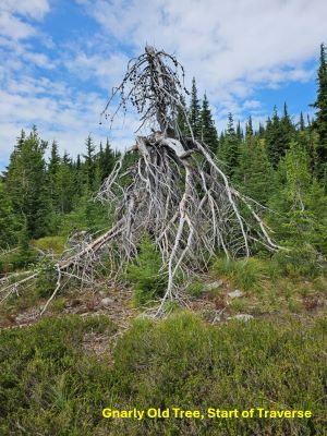
 Follow the trail across the hillside until you get to this really gnarly dead tree, see picture in text. The trail you are on disappears shortly after that. From that tree face straight down the hill, and head down. Your goal is the top of the drainage where it appears a stream channel is starting to form. It may take some looking to find the trail but it is there. If you can't find the trail then traverse the hillside at about the same elevation, staying below the heaviest rocky areas. There is a detailed description in the Trail 738: Schley => Cache Creek page.
There are other game trails that traverse the hillside but they do not go all the way to the water. Remember, your goal is the water stop. The trail is much easier to find on the way back. This is a rare place on the state line where running water is available. This is about the halfway point to Leo and Smokey. At this point a nice well-defined trail is visible that heads south along the ridgeline. Stay on this trail; there used to be a trail sign and trail that would take you down into the Middle Fork of Kelly Creek but that seems to have disappeared, so stay on the ridge top.
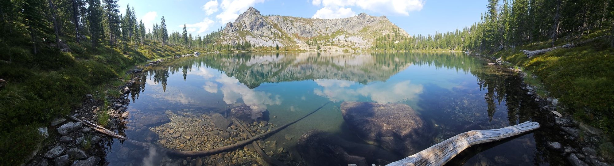
About a half mile from Leo Lake there is a prominent rocky outcrop about 20 feet above the trail. Make sure you take a few minutes here, this is just an unbelievable view of upper Cache Creek, Granite Peak and Pilot Knob in the distance. Cache Creek is an expansive drainage system. Continue for another 1/2 mile to Leo Lake for a total of about 5 miles. The trail from the water stop to Leo Lake has deteriorated over the years, due to lack of regular maintenance and use. There is a lot more deadfall and many small trees are now growing in the trail itself. However, I have found that horse packers do clear out some of the trees blocking the trail, but it is not regular maintenance.
A good trail continues around the right side of the lake and climbs steeply up towards the prominent saddle.  The trail crosses a small stream (inlet to Leo Lake) and stays along the left hillside as it climbs continuously to the state line. This portion is just a primitive trail, so don’t expect too much here. The farther up the hill, the worse and steeper the trail gets. North Cache Lake is virtually on the state line 450 feet above Leo Lake, The lake is a stone’s throw down the hill. This is the highest lake along the state line that are included in these descriptions.

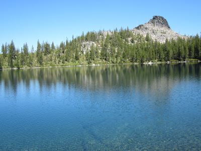
At the Lake: North Cache Lake is on the small side with no fish. The Montana Fish and Game used to stock the lake back in the 70’s and 80’s but decided in the late 80’s that it was too remote to stock and there is no natural reproduction. The fishing used to be excellent, but I haven’t seen any fish for several decades. There were a couple primitive campsites on either side of the outlet, but in 2023 they are all but gone. If you are spending the night, it will almost certainly be alone with no other people, except for an occasional deer. I have been to this lake multiple times and I have never seen anyone else outside of our party. The lake is very good for swimming and sunbathing on the rocks. I would spend some time just above the outlet as views of the upper reaches of Cache Creek are awesome.
One summer weekend I spent the night without a tent, just a bivy sack and sleeping bag. At dusk a mule deer doe came wandering toward my camp. I was in my sleeping bag by then so I just kept quiet to see what she would do. After a few minutes of circling my position she came right up, stood over me and sniffed my head. Satisfied at that she grabbed my pack lying next to me and started dragging it off. She wanted the salt on my pack straps and wouldn’t leave it alone even if I had it right next to me. I eventually had to put my pack up in a tree out of her reach for the night.
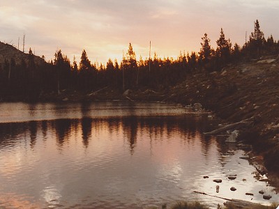
I had some good pictures from the early 1980’s of this lake and I made it a point in 2023 to try to take comparative pictures to show the changes over 40 years.