Getting There: Take the Fish Creek Exit on I-90 and proceed up Fish Creek Road #343, for approximately 16 miles and turn right on Surveyor Creek Road #7734 for 12 miles to the Schley Mountain Trailhead. This is a rough 12 miles, especially the portion past the Surveyor Lake trailhead at 8.5 miles. The Schley Mountain Trailhead has several places to camp and park along with a vault toilet. This trailhead and campground are dry, so bring plenty of water if camping. This is not the actual end of the road. The gate is only open from when the snow is off until August 31; the gate is not open over Labor Day weekend.
The road behind the gate is designated by the Forest Service as a non-maintained road. The Forest Service does not maintain or brush out this road. If you are the first one through the gate in the summer, then expect to saw out the downed trees from the winter storms if you want to drive the 3 miles to the end of the road and the old trailhead.
The road is pretty good until you reach the 2 switchbacks, and the road gets decidedly worse from there for the last mile. Pullouts are a bit scarce so someone may have to back up a way when meeting another vehicle. The trailhead has plenty of room for parking and several camping sites; the ridge trail from Schley Mountain connects back to the road. The road continues beyond the gate.
 Hike this road, bearing left and up after 1/3 mile; the stateline and trail number #738 is about 1 mile from the trailhead. Once on the stateline stay on the main road / trail that heads north with great views of the Kelly Creek drainage with Shale Mountain and Rhodes Peak in the background. The road / trail will split again at the 2-mile mark with the right fork continuing to the South (Big) Cedar Log Lake and the left down to Kid Lake.
 Stay right for about a 1/2 mile until you can look down on the lake. The trail is fairly level but a bit brushy with Alders covering the trail. There is a good spring about halfway to the drop into the lake that is deep enough to filter water. There is evidence of an old mine here at the end of the road, but you will have to look for it now-a-days as the trees and brush are thick. Back in the 60’s you could drive to this point. The trail down to the lake is steep and relatively un-maintained; it can be treacherous if slick. It takes 10-15 minutes to navigate your way down the 500-foot drop to the lake.
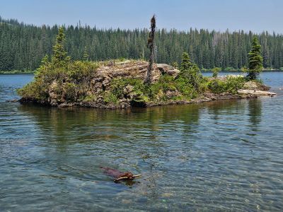
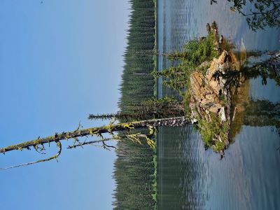
At the Lake: This is a big and deep lake. There are several camp sites around the lake and past the outlet, but the shoreline can be difficult to maneuver in places due to the amount of brush. Once at the lake you will have to navigate a bog to get to the shore; a misstep will result in a knee deep step into the mud. Because the hike isn’t too hard, a lot of people do bring small rafts into the lake. Fishing is very good at times, and you can catch some big fish here. This lake can have an overabundance of biting flies and mosquitoes, so be prepared.
I was crossing the outlet years ago on my way to the North Lake and saw what could have easily been a 24-inch trout in the outlet stream. This lake does get a lot of traffic when the Schley Mountain Trailhead gate is open but is relatively unused otherwise. I once swam out to one of the small islands and fished off it, didn’t catch anything.
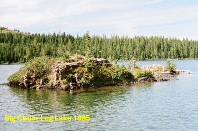
Like a couple other lakes in the region, I have been to this lake many times but only can find just a handful of images. I revisited the lake in 2024 and updated the description and added some newer pictures. After the gate is closed at the newer Schley Mountain Trailhead, the lake doesn't get a ton of traffic. I have walked and ridden a bicycle over the extra 3 miles. It is great going in as the road is mostly downhill but not as much fun coming back.