This entry consists of a weeklong stay with the trailer at the Missoula Lake Campground at Cascade Pass and the hikes completed during that week. I took the trailer up to Missoula Lake CG on Tuesday afternoon and set up camp in the wind. I had the grand plan to visit all sevens lakes that are accessable in the area along with hike into Frog Lake; which I haven't been to before. My sister Debbie and her husband Roger arrived on Wednesday afternoon and Kelly and Suzy came in on Thursday afternoon. I drove back to CDA on Friday night to pick up Kathy and the rest of the food.
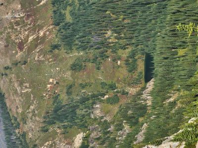
Bonanza Lakes: I woke up on Wednesday to 33 degrees at the campground and overcast. I had planned to go to Frog Lake that day. But when I got to Cascade Pass, the wind was blowing and it was storming all around, so I bagged the plan. I went back to camp, made another pot of coffee and read for a couple hours. I was hoping the weather would break a bit by noon, but it started snowing around 11. At noon I went ahead and headed over to the Bonanza Lakes, as it had warmed up to 38 degrees and quit snowing. I have been to the Bonanza Lakes around 50 times in my life so my thinking was "What could go wrong". With that thought, here is how things can go wrong.
A number of years ago my brother, Kelly, was hiking into the Bonanza's early in the summer. He had to park before the trailhead due to snow and hike from there. There was still some snow over by the saddle and intersection with trail #616. He stepped through the snow and tore his Achilles Tendon. As it turns out, the saddle has phone reception and he called the Mineral County Search & Rescue. The S & R said it was too dangerous for their people and refused to send anyone on foot; all Kelly wanted was some help getting back to his truck. Instead the S & R called for a helicopter rescue, with the helicopter coming out of Great Falls.
Kelly eventually limped back to his truck and got home. He called the S & R to let them know he made it home on his own. Good thing because the helicopter was getting ready to take off. I think the guy in charge of the S & R at the time really wanted to direct a helicopter rescue, thus the reason to not to send any people to help. Skye & I hiked over to the lakes & back without incident. Debbie & Roger had already arrived and were setting up their camp.


St. Joe Lake: Thursday morning brought a slight warm-up to 34 degrees, but the weather was clear and sunny. Debbie, Roger & I (with Skye) were heading to St. Joe Lake via trail #49 that runs up the valley to the lake. This is a relatively easy trail for the distance (5 mi) and elevation gain (~1,450 ft), with only the short climb around Rambikur Falls being difficult. It was a good hike except that Debbie's knee was giving her trouble at the end of the day. I am always a little disappointed in how degraded the area around the outlet is due to all the large campsite footprints. There was a lean-to of sorts at one site. The person who put it up probably thinks they are some kind of woodsman, but all they did was make a mess. I guess it is very popular at times; someone once told me that finding a campsite can be difficult on weekends. Since I have only been to the lake during the week, I have never seen anyone else at the lake. Kelly and Suzy arrived at the CG around 5:30.
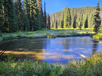


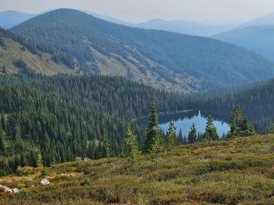
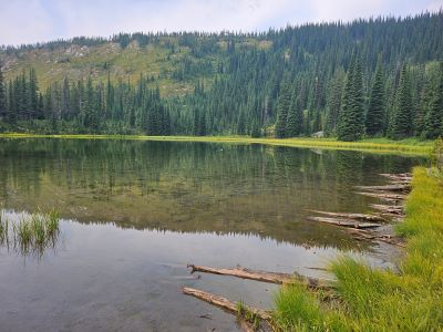
Upper Oregon Lake: On Friday, Kelly, Roger & I hiked into the Upper Oregon Lake. We hiked from the campground up over the low saddle that sits directly above the lake. The trail needs some TLC as it is getting overgrown and at times hard to follow. The headwall of the drainage is a short but steep 250 ft climb over a tenth of a mile and then an easy 350 ft drop into the lake on a good trail. As usual, the fishing for Brook Trout was outstanding, catching (& releasing) around 9 trout in 30 minutes on a fly with Kelly catching at least 4 on spinners. A couple of them were actually of good size. It is interesting that Google Earth is now labeling the lake as "Heart Lake of the Oregon Lakes Trail". Kelly and Suzy went home on Saturday.

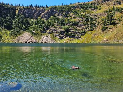


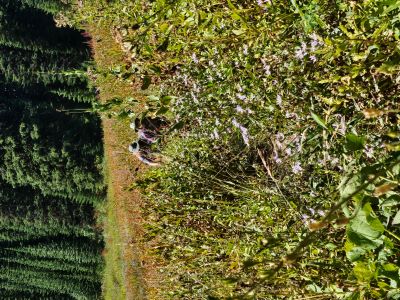
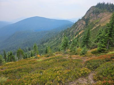
Upper Oregon Lake Overlook: On Sunday afternoon after Debbie & Roger left, Kathy and I hiked along the stateline trail towards Illinois Peak to the overlook of the Upper Oregon Lake. I hiked up to the left to the high point above the saddle that Kelly, Roger & I crossed on Friday. This is a great view as you can see all 3 of the Oregon Lakes from this ridgeline. We met around 8 people on the trail that day. Skye & I went down to Missoula Lake after we got back for a swim. There were around 10 people in boats or on the shore fishing or just lounging while I was down there.


Frog Lake: On Monday I headed over to Frog Lake, a lake that I have never been to, heading North along the State Line Trail #738 from Cascade Pass. My original plan was to visit the lake and then hike to the top of Binocular Peak that sits directly above the lake. However, the weather was supposed to change during the day with a new system arriving so I left the peak as an option. I made the overlook above the Upper Bonanza Lake in 1.5 hours then it was down the hill to a point where I believed the old trail to the lake takes off. The old trail takes off at the only EASY year round water source on the state line trail between the Dry Creek trailhead and Cascade Pass.
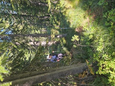
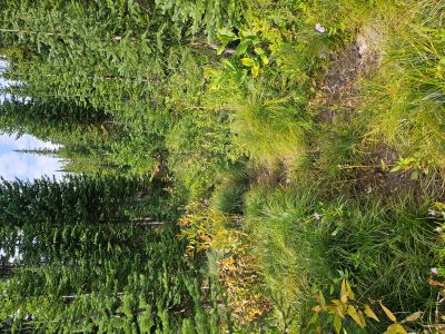
The clearly visible trail to Frog Lake heads straight ahead from the water as the state line trail heads immediately uphill to the right. The trail goes uphill for a bit. It would be easy to think this might be an abandoned portion of the state line trail, but it is not. You soon pass a small seep area and the trail starts to angle downhill towards the lake. Take your time as there are deadfalls and ingrowth areas that interrupt the trail, but I found the trail doesn't deviate from its current direction past these obstacles. If you can keep to the trail it is an easy hike in and back out to the state line trail. Compared to some trails I have hiked this summer, this was a breeze to follow.
Frog Lake is just a pond less than 10 feet deep and it is aptly named as there are a ton of frogs. There is an old campsite near the outlet. The outlet was dry so I assume the water would not have a great taste this time of year. The inlet area was very swampy so not sure if any water is physically running into the lake this late in the summer. If I was staying overnight at this lake I would pack water from the small stream at the junction rather than test the water at the lake. I would only stay here if I wasn't able to make the Bonanza's or Dry Creek.
I opted not to climb Binocular Peak as the winds had really picked up by the time I left the lake. I did take a quick side trip on a trail that takes you over to an overlook of Lost Lake and the Lost Creek drainage. The trail takes off at the top of the steepest climb heading back and is blocked by some logs, there is also a sign of sorts in a tree. I believe this trail will eventually take you to Lost Peak, but have not hiked it. The overlook to Lost Creek and Lake was not great as there was a lot of smoke in the air that day, it would be better on a clear day. The wind really picked up to 20+ mph so I headed back to the state line trail and Cascade Pass; although after I got back to camp it cleared off and calmed down. I mapped out the distance to Frog Lake as 4.40 miles from Cascade Pass.


Overall Summary: In the end I visited 6 lakes and hiked almost 32 miles with just the Lower & Middle Oregon Lakes missing from the week's hikes. There were 2 couples camped across the road from us. They were great folks; a couple from CDA & their 2 very friendly dogs wanting chest rubs, and a couple from Stevensville, MT who had great success fishing Missoula Lake. A friend of theirs from CDA joined them on Sunday afternoon. They shared some "outstanding" fish from Missoula Lake with us and also some whiskey. Had a great time visiting with them around the fire about skiing and outdoor adventures. Hope to see the folks from CDA at Lookout this winter. The actual weather came in Monday night and it rained hard for most of the night and sprinked on and off on Tuesday morning before we left.
Binocular Peak: I had hoped to tackle Binocular Peak on Monday when I hiked into Frog Lake, but that didn't happen so I went back to Missoula Lake Campground on Friday afternoon to hike Binocular Peak on Saturday. I was the only camper at the campground on Friday evening, but 2 parties came in after dark and there was a group that camped on Cascade Pass. Skye & I went down to Missoula Lake on Friday evening to fish a bit; I didn't have much luck with just a couple bites.
Saturday was going to be hot so we got an early start at the pass. I met up with a young fellow above the Bonanza Lakes that was bow hunting in the area. He warned me that there was a black bear with a deer kill just over ridge along the trail over to Lost Peak; about a tenth of a mile from the stateline trail. I had thought about going over there again as it was really smokey on Monday when I took a couple pictures of the Lost Lake and the Lost Creek drainage, but that killed that idea. I passed by the area without incident.
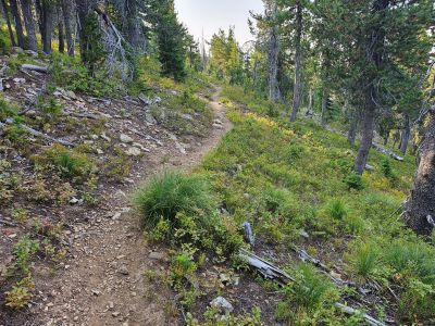
I left the state line trail at the intersection with the Lost Peak trail and angled over to the low saddle on peak's ridgeline. There were numerous game trails along and just below the ridge so it was easy going for most of the way. There is a good trail just past some of the rockslides that will take you to the summit, but you need to stay a bit higher on the ridgeline to access it. The last couple hundred feet of this trail is very steep, basically straight up the hill.
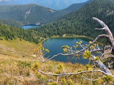
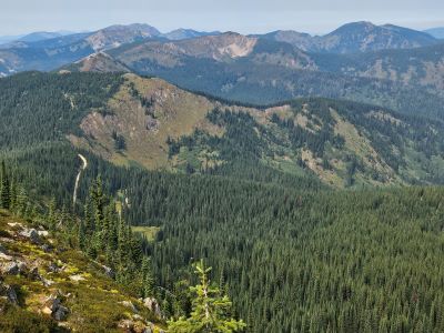
The summit has a stateline marker, but not a benchmark. The views from the summit are good. To the north Eagle Cliff Peak dominates the skyline with excellent views of the Dry Creek drainage; Heart Lake and it's sister pond are also very visible. Trail #151 that connects to the state line is also very visible. Looking down the east ridge toward Lost Peak is also very good. There was a lot of smoke on Saturday so looking South and West were not great views on Saturday. The long ridge off the peak to the south and basin below were also good views.
We stayed for about 45 minutes and had lunch then headed back down the way we came. It was getting hot by that time. I brought almost 6 liters of water and electrolyte mix and we had just a half liter of water left by the time we got back to the truck. On the way back Skye would get ahead of me, then stop in the shade and wait, then take off again when I got close. I mapped out a distance of approximately 4.1 miles over to the peak from Cascade Pass, so 8.2 round trip with no side trips. There is no water on this route unless you make significant deviations from the ridges.