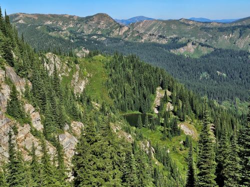
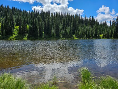
Goose Lake: I started the trip at the Goose Creek Trailhead in Idaho on Wednesday early morning. It had rained the day before and I was hoping that the trail would have dried out a bit late in day and into the overnight hours. Totally wrong about that. It had also been several years since I had been up this trail and I hadn't remembered it being that brushy. Well, I spent most of the hike totally soaked from head to toe with water squishing out of my shoes. I have never camped at Goose Lake before as the Trio Lakes were more attractive or was just passing by on the way to the Siamese or back. Goose Lake is more or less a shallow pond like Mud Lake with a large horse camp; and it seems to be a bit bug infested based on past visits. I was pleasantly surprised that there were virtually no bugs present. I made camp over by the inlet stream, changed clothes, hung up things to dry, ate an early dinner and headed over to the Lower Trio Lake.


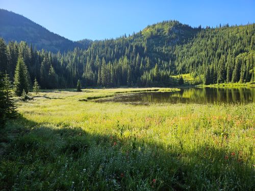
Lower Trio Lake: I have been to the Lower Trio Lake a couple times in my life but could only find 1 picture of it for this site. It is an easy 1.5 mile hike from Goose Lake. The unsigned trail #338 takes off from the North Fork Trail #103 about 1/4 mile down from the state line. About halfway over to the lake I started seeing a large wolf track from previous day's rain in the trail. I didn't see anything nor hear any howling on my trip. I put a spinning rod together and quickly caught a nice 13-14 trout. I had a couple other good strikes but the lure with only 1 bent barb for catch and release doesn't lend to really hooking fish. I was hoping to get some new pictures at the lake but the sun was just not in a good position so I had to wait for it to go down enough to get some pictures. I hustled back to Goose Lake as it was getting late and Skye and I are usually in the tent by 8:30 on most camping trips.


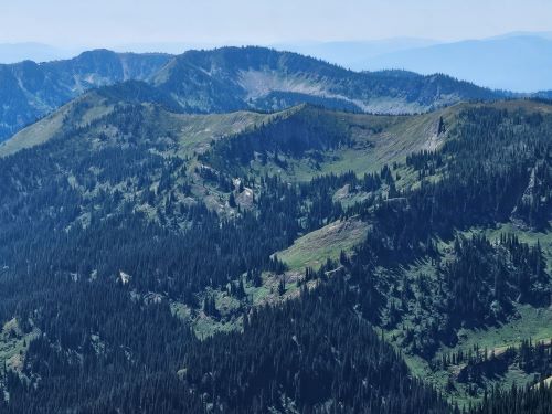
Crater Mountain: I have long wanted to get to the top of Crater Mountain, but never really made a point of it until the last couple years. My planned route was to climb up the main ridge from the state line and follow the narrow ridge around to the final summit point. There was quite a bit of dew in the morning so it was back to wet feet as I hiked up the trail to the stateline. From the stateline, I followed up the ridge on a somewhat marginal trail over the first high point of the day. I then picked up a marginal trail traversing the hillside for a bit and then angled up to a low saddle before making the push up the hill to the narrow summit ridgeline.
We did really well, but finally got to a point that I knew we weren't going to get there. Even though I had 5 liters of fluids, I knew it wasn't going to last for the entire trip (we ran out on the way back). Skye just isn't a hot weather dog and she was starting to suffer in the heat. It was quite a bit warmer than the day before and the route was dry.
The other issue that cropped up were the biting flies. There were no bugs the day before but with the temperature increase they were out in force, even on the high ridges. Every time we tried to take a break at all they would just descend on us. I have doggy repellant for Skye, but they were horribly persistent and I was just sweating mine off.
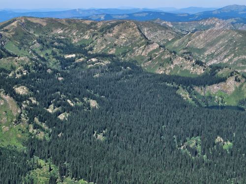
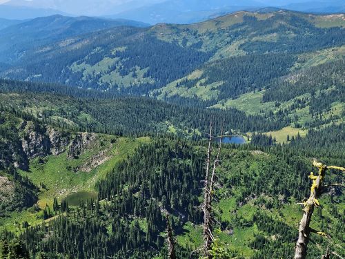
That being said Crater Mountain probably has some of the best views along the state line between Thompson and Lolo passes. The views looking back toward Hoodoo, the Steep Lakes and Upper Straight Creek are pretty nice. There was a herd of Elk down in the basin below us. We made it to about 7,200 feet but it would have been a hard time get to the summit along that ridge.
We made it back to Goose Lake and the flies were just as bad there; I was hoping to get a swim in but that wasn't happening. I had to go into the tent just to change shirts. So I made the decision to pack up and leave instead of staying another night. We completed a forced march back to the trailhead before dark and got home in CDA just after midnight.
Although the route that I tried was very spectacular, the better route (I believe) up Crater Mountain follows that marginal trail that I followed before angling up to the main ridge. This trail appears to follow around the mountainside and into the basin below Crater (with the Elk herd) that I was viewing from the ridge. I could see the trail through most of the basin and then it angles steeply up to summit ridge past the peak and then heads back to the summit. When I was at French Lake, I talked to a couple with horses and they said they took the horses up Crater. This must be the way they did it as the route I took was only friendly to goats. There is a small lake in the basin so that would solve the water issue we had. A plan for next year.