My son Colter and I made plans to climb West Goat Peak in the Anaconda-Pintler Wilderness this past weekend. We had been on the peak from the Warren Lake side when he was a scout (many years ago), but lightning that day derailed our attempt. So we were both interested to try again, but we ended up with a September date due to work and family obligations. This time we were going to try from the Middle Fork of Fishtrap Creek on the East side of the range. While researching this route, I found a couple other posts about the route: Eric Higginbotham's Description and Aaron Schye's Description. Both descriptions are informative.
Armed with a little knowledge, Colter and I headed over to Montana on Friday morning. We took Hwy 569 at Anaconda that connects with Hwy 43 between Wise River and Wisdom; then a right on Calvery Creek Road for about 5.3 miles and then right on FS road 1229 for about 4 miles. You will pass the trailhead for the West Fork Fishtrap Creek at the 2.5 mile mark, it has a nice informational sign. At the Middle Fork trailhead there is a parking area on the right with some signage (No Motorized Use) on the left where the Middle Fork trail takes off. We used the truckbed tent and just slept in the truck at the trailhead. If you go up the road for less than a half mile there is a nice spot to camp on the left.
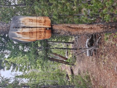
It was still dark at 6:30 when we got up and were on the trail just after 7:30. The first 1.25 miles is flat until you cross the meadow. Don't overthink this, just head straight across in the same direction as the trail and the trail picks up on the far side. There was a lot of bowhunter traffic in the area so there was actually a visible path across the meadow for us that morning. The trail then climbs steeply for the next 3/4 of a mile to the Wilderness Boundary.
You get a quick break and then it is uphill (not as steep) for another 1/3 mile. The trail then heads downhill for a short distance then levels off or climbs easily for a while giving your calves and lungs a break. You will come your first creek crossing of the day, which a bit more than halfway to the saddle where trails #129 & #128 meet.
Take a look at how the creek is formed and running. Colter believes that this is a manmade feature to divert water from the Middle Fork to Swamp Creek. The stream runs nicely along the contour before dropping into Swamp Creek and appears to be dug out. From this crossing the trail climbs again for a short distance before hitting a flat and a series of swampy areas and small stream crossings.
Eventually, you will get to the marshy area that seems to causes issues for some. Again, don't over think this, head straight across the meadow in the same direction the trail enters the meadow. You will have to adjust a bit to avoid the wetter areas, but on the other side there is a blaze and a large cut log where the trail picks up again at the treeline. There is no need to swing left into the trees and do not head deeper to the right into the meadow.
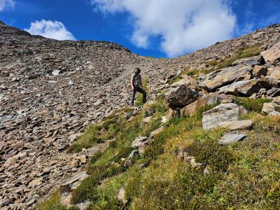
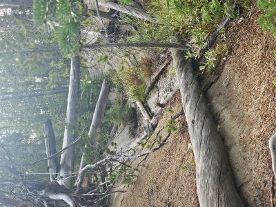
The trail then starts to climb steeply for over a 1/3 mile to the saddle between the Middle and East Forks of Fishtrap Creek. This is a rough and rocky section and not easy either up or down. As described by others there is a sign and fire ring on the saddle. There is a trail (covered with deadfall) that takes off to the left up the ridge toward the peaks. The unmarked trail is in good condition and easy to follow as it stays just below and right of the ridge crest.
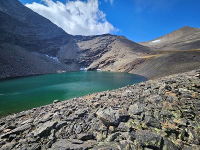
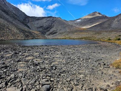
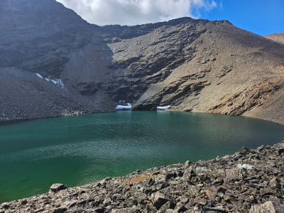
Eventually, the ridge will become much steeper, cross East Fork of Fishtrap Creek at that point then work your way up a more gradual slope to a flat just below the Lost Lakes. There is a nice campsite with a fire ring and the creek is just down the hill to the left a short distance. From the campsite you can see the notch for the outlet of the Lower Lost Lake, it is a steep climb straight up the talus slope.
The Upper Lost Lake is nestled up against the lower cliffs of East Goat Peak. West Goat Peak sits to the right from the lakes with both ridgeline routes clearly visible. Unfortunately, it took us almost 4.5 hours to get to the lakes; estimated at 6.5 miles with 3,150 feet of elevation gain; and I was running a bit low on energy. It would have been another 1+ hours to the top that would have left me spent and having to complete a non-technical but still tricky descent on the talus and 6 plus mile hike out.
So we decided not to try for the summit, had lunch, looked over into the upper LaMarche Creek Drainage and at Cutaway Pass in the distance, then headed back down, arriving back at the truck in 3.5 hours. My knees were definitely protesting on some of the steeper parts of the trail. After a 15 minute break and a beer we packed up camp and headed home.
If I were to attempt this again (probably will), I would backpack into the upper camp below the lakes, get up early and climb West Goat to beat any thunder storms then break camp and hike out in the afternoon. The hike in would be hard with a light but full pack, but I now know the trail and creek crossing so I know what to expect. We found the trail easy to follow and never had any issues losing it. Stay patient around the deadfall and marshy areas, there are many blazes and cut downfall on the trail. The trail is steep and rocky, but there are nice flat sections that allow good recovery strolls.