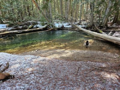
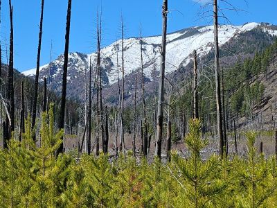
On Thursday, Skye & I headed over to the Clearwater Crossing up Fish Creek with the purpose of hiking up the West Fork to the 3-mile bridge, a 6 mile round trip. Wanted to check out the condition of the trail and see how much snow is back in those drainages. The trail was in okay shape with around 20 or so deadfall across the trail through the burn. Most you could just step over but there were several that you had to either duck under or climb over. We didn't run into any snow until we got out of the burn and back into the trees. It was about a 1/2 mile hike on the snow to the bridge. The bridge, built in 1981, is slated for replacement this summer, July & August. The campsite and the beach at the swimming hole was still covered in snow and ice. I didn't not go any further up the trail. There were some mountain lion (I believe) tracks on the trail, but were a day old at least. One other person had been on the trail prior to myself. There is still a lot of snow in the higher elevations, runoff hasn't really started yet up Fish Creek. It was just above freezing when we started around 10 am. The trailhead is 3 hours from Coeur d'Alene.


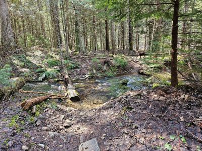
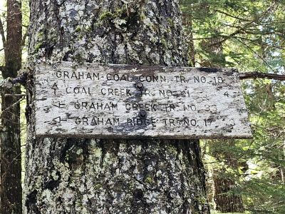
On Sunday, Skye & I stayed a little closer to home and hiked up Graham Creek, a tributary of the Coeur d'Alene River. The trailhead is a little bit past the 14 mile marker up the Couer d'Alene River Road. There is a sign for the trailhead and a bridge that crosses the creek there. The trail quickly climbs and switchbacks up the hill above the creek, but never fear that is short lived. The trail levels out and slowly gets back to the creek bottom in less than a 1/2 mile. The hike is easy and mostly level for the next couple miles. There is some deadfall to negotiate as the trail is on the edge of a burn area. There is one section where you leave the trail and go around the deadfall for a couple hundred feet; a new trail is being formed from the traffic. There are 2 small creek crossings. I ended up just wading the first crossing as the log was unstable and slick and I didn't want to end up on my back in the creek. Snow was hit and miss in the last 1/2 mile before the junction. The left trail is a continuation of Graham Creek Trail that heads steeply up towards the Graham Mountain trail and straight ahead is the Coal Creek Connector Trail. I went up the connector trail a bit, but snow and deadfall were discouraging. I also went up the main trail for a while to the first draw and more deadfall. Dispite the deadfall, this would be a good family friendly trail for a summer hike as the trail is heavily shaded and near the creek. The only wildlife I saw were the 2 ticks I picked off of me. There were a day or so old bear tracks in the snow and trail.