Getting There: For this description I hiked into the lake from the Up Up Ridge Trail #250 that runs from near the Up Up Mountain Lookout to the state line road #391. This trail passes over or near Gold Peak, Eagle Peak and Ward Peak.
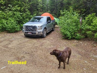
Take the Ward Creek Road (# 889) exit off I-90. The exit is only accessible from the East bound lanes and sits right on a sharp corner, if not paying attention you could miss it. Drive (~3 miles) to road #3816.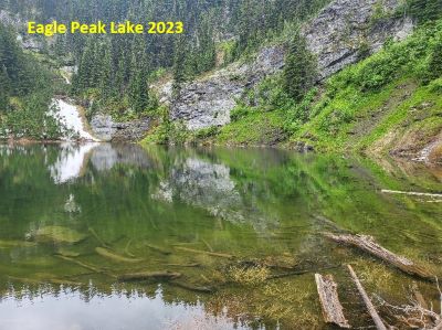 There is signage for the lookout. Stay on this decent road for about 11 miles to the trailhead for Trail #250, there is a hiking marker in addition to a lookout marker. The trailhead is a small level pull/back in with room for a tent and vehicle.
The trail immediately heads steeply up the ridge for a couple hundred yards before easing up a bit as its switchbacks up the ridge for about a mile. The trail then flattens out and follows along the ridgeline for another 3/4 miles, staying mostly on the right side. As the trail approaches Gold Peak, it swings over to the left side of the ridge and descends into the upper part of the small basin below Gold Peak.
There is a small pond and water source there at mile 2.75. This is the only water source that I am aware of between the trailhead and the state line road #391. The trail then climbs back up to the gentle ridge between Gold and Eagle Peaks. Take the time to climb to the top of Gold Peak. The trail to the summit takes off to the right of the meadow on the ridge top. It is a decent trail that takes you directly to the summit, a distance of 1\4 mile.
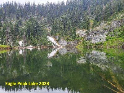 From that meadow, follow the ridge trail for about a 1/3 of a mile to where the trail starts to climb to Eagle Peak. Hang a hard left and find the best route down and through the trees, eventually coming out at the top of a steep grassy slope. There is no official trail once you leave the Up Up Ridge trail. There is a very primitive trail in the trees that ends on the aforementioned slope, but it is sketchy at best.
Descend the hillside into the basin towards the small stream coming out of the rocks in the draw. If you don’t need water, continue down the low ridge to the left of the stream until you come to some rock outcrops on top of the ridge. The ridge will swing more to the left and if you follow it, you may miss the lake. Head right off the ridge down and towards the stream in the draw. The lake has a small profile, and the trees are thick, so you won’t see the lake until you are almost there.
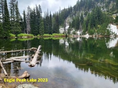
At the Lake: Eagle Peak Lake is a small lake with no fish population. I did not see any campsites where I came into the lake nor the portion I explored. It was very early in the year and the areas away from the lake were very swampy with some remaining snow and standing water. It is interesting that the stream coming down the draw is not the inlet stream. The stream comes within 100 feet of the lake and then swings around the lake and connects with the outlet stream later down the hill. The true inlet stream comes off the Eagle Peak side.
 The lake has a dike-like berm of several feet around most of the lake. That is unique as most lakes in the burn area do not have that feature as the low feature is the outlet. I didn’t work all the way over to the other side of the lake so there may be a campsite over toward the ridge that divides the drainage from the Hub/Hazel Lake drainage. There was still some snow and was very wet with lots of standing water away from the lake and dike. Return to the ridge trail the way you came.
Bonus Route: I originally planned to make this a point-to-point trip where I would be dropped off at the Up Up Ridge Trail #250. From the lake I would climb up the low (but steep) ridge on the east flank of Eagle Peak and then connect with the Hub / Hazel Lake trail and be picked up at that trailhead. This would be about an 8.5-mile trip, one-way. I think this would be a great point to point trip; not something completed by many people.