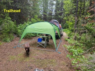
Getting There: For this description I hiked into the lake from the Up Up Ridge Trail #250 that runs from near the Up Up Mountain Lookout to the state line road #391. This trail passes over or near Gold Peak, Eagle Peak and Ward Peak.  Take the Ward Creek Road (# 889) exit off I-90. The exit is only accessible from the East bound lanes and sits right on a sharp corner, if not paying attention you could miss it. Drive (~3 miles) to road #3816. There is signage for the lookout. Stay on this decent road for about 11 miles to the trailhead for Trail #250, there is a hiking marker in addition to a lookout marker. The trailhead is a small level pull/back in with room for a tent and vehicle.
The trail immediately heads steeply up the ridge for a couple hundred yards before easing up a bit as its switchbacks up the ridge for about a mile. The trail then flattens out and follows along the ridgeline for another 3/4 miles, staying mostly on the right side. As the trail approaches Gold Peak, it swings over to the left side of the ridge.
There is a large rock (4’x6’) next to the trail.  This is your jumping off point to stay on the ridge to your right and continue towards Gold Peak. Your goal is to head for the rock fields below Gold Peak and follow them to the lake, well mostly to the lake. Although tempting, don’t dive off the ridge too soon as you could miss the lake as it has a small profile and it is not visible until almost there.
There is cell coverage (De Borgia) all the way to the lake, so maps work here and there is enough of a signal to view imagery. Follow the path of least resistance on the ridge and as you angle down towards the lake. It is steep and at times brushy, but mostly steep.
You don’t see the lake until about 100 yards to go. 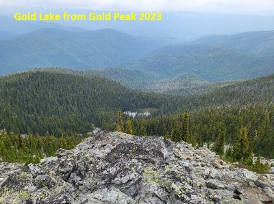 I didn’t venture out into the rockslides; it is possible that there might be a better view from there. There is no water between the trailhead and the lake so plan accordingly.
At the Lake: Gold Lake is a small lake and mostly shallow. The shoreline is brushy and difficult to navigate. I arrived at the lake near the inlet, had lunch on a small rock outcrop. I did not circle the entire lake, there doesn’t appear to be any kind of trail around the lake. I fished for a bit but didn’t catch or see any fish following my lure. There were a couple of small fish rising across the lake but nothing in the water where I was at. I didn’t see any evidence of a camp on my side of the lake. The old stocking reports indicated that none existed back at the stocking report date.
The return path is a tough 800-foot climb back up through the brush and deadfall. Staying on a small ridge or near the rockslides helps but is no guarantee to be easier.
I previously tried to hike into the lake via the outlet drainage from Deer Creek. The old stocking reports describe this as the way into the lake. But those reports are old (1970's), and the amount of deadfall made the going almost impossible. It is a shorter distance, but I found it to be very hard. In general, I have found most of the off-trail travel off the ridgetops and especially going north along the state line from the Diamond/Cliff Lake area to be problematic.