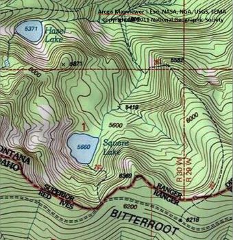
Getting There: Take the Little Joe Road (#282) out of St. Regis and then take the state line road (#391) at the summit for about 4.5 miles, give or take. The trailhead is a well beaten down area situated in the saddle before Ward Peak. There is a hiking trail sign visible, but no names. 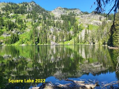 The state line road gets considerably narrower and rougher at that point.
If you are tempted to follow the road out to eventually get to the Hiawatha Trail, make sure you have a couple hours to spare, a servable spare tire and a chainsaw. Razers, jeeps and side-by-sides use the road and do not cut out the deadfall to standard truck width. I have seen cars on the road past Square Lake, but I wouldn’t take one.
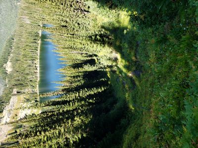
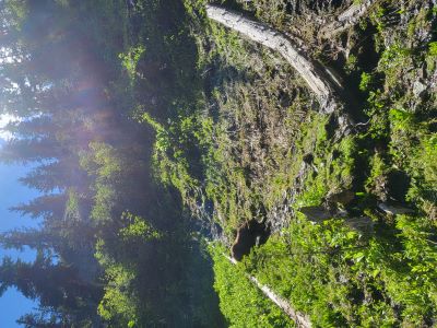
The trail (#261) itself dives off the saddle, and I do mean dives. This rivals the Clear Lake trail and, in some ways, surpasses it. About halfway down you do get to a small flat spot where there is room to camp. The last time I went to the lake there was blow-down around the campsite, so it lost a bit of it's area.
At this point the small stream (the lake inlet) that you have been hearing to your left joins the trail and now the trail is not only steep, but it is also quite slick in places. It would be real easy slip and take a bad fall along this stretch, so be careful. The trail cuts to the right across the slope a bit and there is a steep little drop and then back into the slick creek bed. You stay near or in the creek most of the way to the lake. 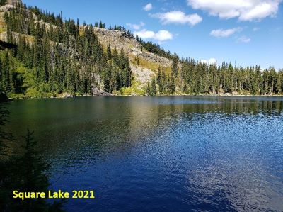
Getting There: From the Square Lake Trailhead, walk up the road about 1/3 mile and then head up the hill to a saddle on the stateline. The climb is not steep, nor brushy or far so the lack of trail is no big deal. You can also just traverse up the ridge from the trailhead if you choose, following the best route available. There is a trail from the Square Lake trailhead that goes up the ridge, but is sporadic at best and hard to follow.
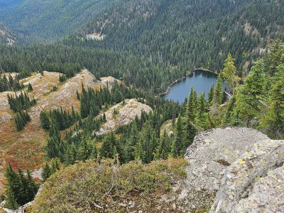
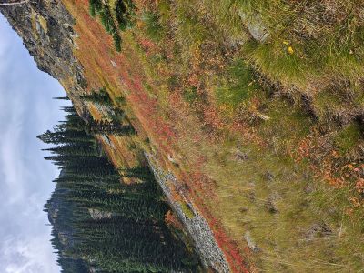
Once at the saddle, look for an obvious trail diving steeply off the Montana side above Square Lake, this is the “Traverse Trail” to Ward Peak Lake. Be aware there is a second small saddle between two rock outcrops down the ridge 100 feet that can lead you astray. The trail quickly heads to the left at a lesser gradient than the start. I would wear some footwear with good lateral/ankle support as the trail slopes downhill at 10-30% for the majority of its length and there is off-trail hiking. The trail at this point is easy to follow as you traverse across the hillside, below some cliffs and then above a small stream in a draw.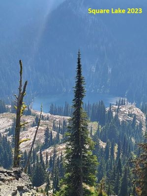 Angle over to the dry & tree'd draw to the left of the draw with the stream. This will take you down through the trees to an open slope where you will pick up a primitive trail that goes directly to Square Lake on the opposite side of the lake of the inlet stream and trail #261.
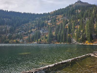
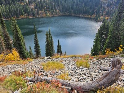
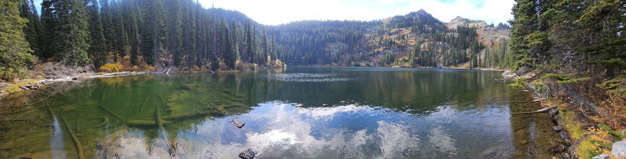
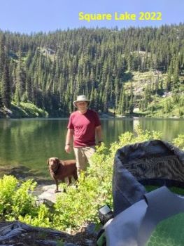
At the Lake: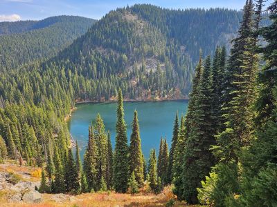 If you come down trail #261 then you end up where the inlet stream comes into the lake on the south shore. There are a couple campsites over to your left. Getting around on this end of the lake is tough as there is plenty of blow-downs and brush. Maybe this will get better over the years, but in 2022 it was bad and not much better in 2024. The fishing is actually pretty good where you can access the shoreline; I would opt for spinners as back casting is a bit limited. I've caught 11–14-inch cutthroats at this lake.
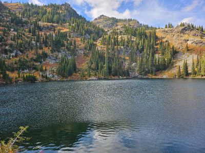
If you come down to the lake via the Traverse Trail, you will find the north shore of the lake much more accessible. There is a nice open campsite just off the shore. The heavy blow-downs don't really start until you get almost to the outlet and continuing around that side of the lake. It is a pretty good grind out no matter which route you take, but the Traverse Trail lacks the blow-downs. For such a short distance from a main road these approaches down to the lake and accessing the shoreline is not fun.