Getting There: From Superior, take Cedar Creek Road #320 and head toward Missoula Lake and Cascade Pass, 25 miles; stay on the main road as there are several other roads that connect. After coming off Miller Saddle, (about 20 mi) there will be an intersection at the bottom of the drainage. Stay straight crossing Oregon Creek. The right fork at this intersection (road #7763) heads down the hill to the Big Flat; the left fork will take you up to the Oregon Lakes trailhead (1/2 mi).
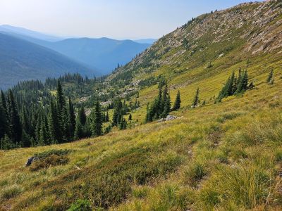
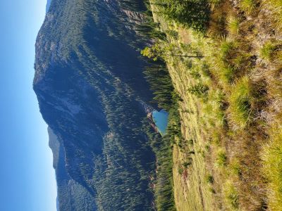
 Starting at Cascade Pass (Missoula Lake saddle) take state line trail #738 North towards the Bonanza Lakes. The state line trail is just across the road from the Cascade Pass sign. The 4-wheeler tract that heads straight up the hill is not it. Head north on this easy and mostly level trail for about 1.5 miles to a low saddle. There, trail (#616) heads down into the head of Cataract Gulch and over to the Bonanza Lakes. Continue straight on trail #738. The trail continues mostly uphill for another 1.25 miles passing several overlooks to both Bonanza Lakes.
The trail then turns downhill for an additional 0.6 miles to the intersection with the un-numbered trail from Lost Peak. The Lost Peak trail is blocked and there is a blaze on a tree at the intersection. You can see the ridge/saddle straight ahead. Leave the trail and angle over to the saddle on the ridge.
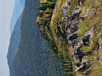
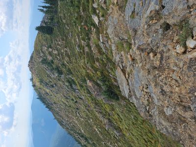
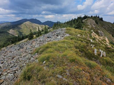
Follow the assorted game trails on or near the ridge until you reach the series of rockslides just off the ridge crest. There is a good visible trail just on the far side of the rockslides that will take you directly to the summit. The ridgeline is also an option but is rougher than Google Earth shows. I have used the trail. The last bit on the trail to the summit is very steep but short. There are no water sources between Cascade Pass and the summit.
Getting There: Take the Dry Creek Road exit off I-90, about 5 miles West of Superior. Cross the railroad tracks on the Southside Highway (#69); after about 3/4 mile, hang a right on Dry Creek Road #342. Continue up Dry Creek Road #342 staying right at the fork to Diamond and Cliff Lakes to the Idaho / Montana state line, a total of about 18 miles.
 From there head south on the state line trail #738, the trail takes off sharply to the left just as you reach the state line. There is a year-round water source about 1/3 mile back down the road in the ditch if needed. The trail varies between climbing and some descents, but it mostly climbs to over 7,400 feet near Eagle Cliff Peak (2.65 mi). Along the way there are several great overlooks of Cliff and Diamond Lakes. It is a short walk back up the ridge to the summit of Eagle Cliff Peak and its very worthwhile vistas.
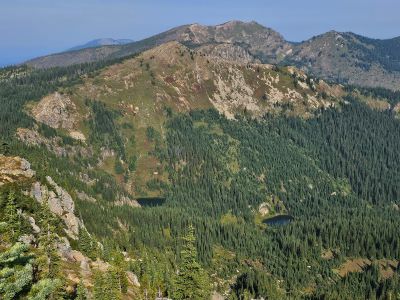
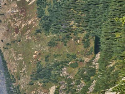
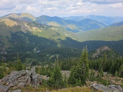 From this point the trail mostly descends, staying on or near the ridgeline with very good views of the main Dry Creek drainage and Hidden Lake. You briefly climb back up to 7,000 feet before descending to the intersection of Dry Creek Trail #151 and USFS Trail #77. This is also a good vantage point to view Heart Lake of Dry Creek. The trail then descends further down to a low flat saddle directly above Heart Lake.
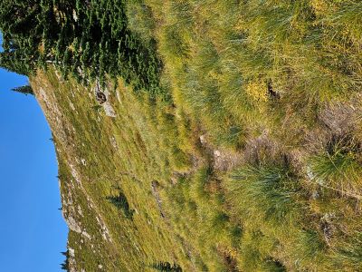
Shortly after the saddle, leave the trail and make your way up to the summit taking the most desirable route. There are several rockslides on the ridgeline, it is easier to stay below them as you angle up the hillside. There is a game trail that does go to the summit from this side, but can be sporadic. It does get much more defined as you get closer to the summit.
I would consider this route to be the harder of the two, not only for the added distance but a definite higher amount of elevation changes. Like the route from Cascade Pass, there are no easily accessible water sources along the route from the Dry Creek Summit.
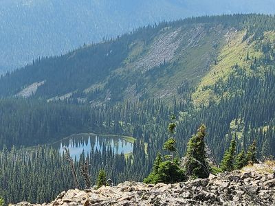
At the Summit: The summit has a benchmark/state line marker in the center of a rock cairn. The view North and East are the best with Eagle Cliff Peak and the Dry Creek drainage dominating the scene. Heart Lake (Dry Creek) and its sister pond along with Dry Creek Trail #151 are very visible. Lost Peak is also visible to the East. The South & West views are not as good as looking North. Do spend the time to walk down the long South ridgeline to the overlook to Frog Lake. Both routes offer some very good overlooks of assorted lakes and drainages.