Getting There: Take the main Cedar Creek Road #320 for around 13 miles and take the left fork (road #388) across the bridge towards the Gildersleeve Mine and Freezeout Pass; there is adequate signage at the junction. It is another 4.5 miles up to Freezeout Pass. At the Pass, take the middle old road / trail #169 that heads directly to the peak.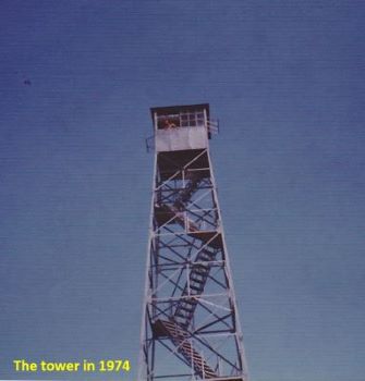 I believe it is blocked now, but you used to be able drive almost a mile up this road back when I was a kid. After about a mile, the old road transitions into a well-defined trail that follows the ridge directly or just off the left side for the remainder of the climb to the summit.
NOTE: In 2023, the Forest Service started a logging operation on Freezeout Pass and down the Cedar Creek side towards the Gildersleeve Mine. This logging operation may last several years.
Getting to Freezeout Pass from the Trout Creek side is as follow: At Superior, take Diamond Road east past the Town Pump Gas Station for 6 miles; passing the Bark mill and the Magone Ranches to the end of the pavement where the road changes to Trout Creek Road (#250). Continue up Trout Creek Road for 12 miles and turn right on Road #7813. Stay on this road for approximately 5 miles to the pass.
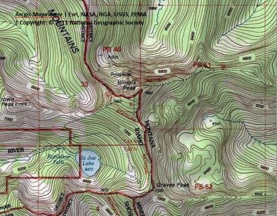
Getting There: From Superior, take Cedar Creek Road #320 and head toward Missoula Lake and Cascade Pass, 25 miles; stay on the main road as there are several other roads that connect. After coming off Miller Saddle, (about 20 mi) there will be an intersection at the bottom of the drainage. Stay straight crossing Oregon Creek. The right fork at this intersection (road #7763) heads down the hill to the Big Flat; the left fork will take you up to the Oregon Lakes trailhead (1/2 mi).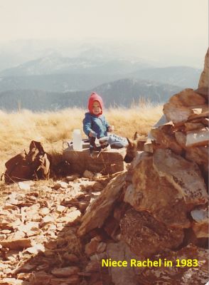 Continue past Missoula Lake to Cascade Pass (Missoula Lake saddle) and take the stateline trail #738 south towards the Illinois Peak for about 3.5 miles to the eastern shoulder of Illinois Peak. At this point the trail splits with the right fork heading down the ridge to Gold Crown Peak and St Joe Lake, continuing straight on the state line trail for 100 yards and then take the trail that heads to the summit, it is about 1/3 mile to the top.
Getting There: At Superior, take Diamond Road east past the Town Pump Gas Station for 6 miles; passing the Bark mill and the Magone Ranches to the end of the pavement where the road changes to Trout Creek Road (#250). Continue up Trout Creek Road (~19 miles) until you top out on Hoodoo Pass on the Idaho/Montana border. About a 1/4 mile before you get to Hoodoo Pass there is an old road (Rawhide Road) that takes off on the right. Rawhide Road used to be the original road that went over Hoodoo Pass.
Drive this rough road for about a mile where the road becomes less travelable without a side by side or motorcycle. Leave the old road at the first corner (1/4 mi) and climb up the trail to connect with the state line trail #738. Follow the state line trail for another 4 miles, leaving the trail for the last 1/2 mile to the Illinois Peak summit.
Getting There: From Superior, take Cedar Creek Road #320 and head toward Missoula Lake and Cascade Pass, 25 miles; stay on the main road as there are several other roads that connect. After coming off Miller Saddle, (about 20 mi) there will be an intersection at the bottom of the drainage. Stay straight crossing Oregon Creek. The right fork at this intersection (road #7763) heads down the hill to the Big Flat; the left fork will take you up to the Oregon Lakes trailhead (1/2 mi). Continue past Missoula Lake to Cascade Pass (Missoula Lake saddle). Instead of parking at Cascade Pass, continue over into Idaho for approximately 3.5 miles; this is still road #320. This section of road is not as good as on the Montana side. Even though it is only 3.5 miles it is a slow and rocky go.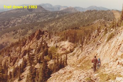 Take the left fork prior to crossing the bridge over Medicine Creek and a short distance to the trailhead. The trailhead is very well used and has multiple camping and parking spots. Trail #49 is an old road for about a mile or so and crosses the St Joe River several times in the first couple miles, although the river is just a small creek at this point. I hiked this route in late August and was able to complete all the crossings without getting my feet wet.
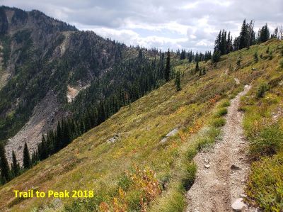
The trail is very easy for the first 2 miles and then starts to climb up the drainage to the lake. The only really steep section is the climb around Rambikur Falls that occurs in the last mile to the lake which is the official headwaters to the St. Joe River.
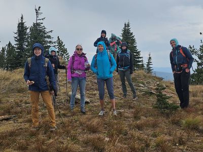
From St Joe Lake take the upper trail from the lake (there was a sign on a tree a few years ago) that climbs up to the saddle between Gold Crown and Illinois Peaks. Continue up the trail to state line trail #738 on the shoulder of Illinois Peak, it is about a mile from the lake. Continue right on the state line trail for 100 yards and then take the trail that heads to the summit, it is about 1/4 mile to the top. I completed this route as a day hike a few years ago and it was a pretty long day from the St Joe trailhead to the summit and back.
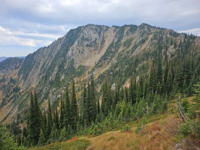
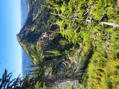
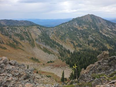
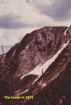
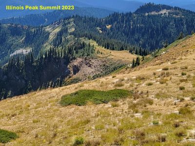
At the Summit:The summit used to have a lookout tower and cabin for the lookout employee. The tower was a 72-foot steel tower with a 6’x6’ box that was built in 1938. There was a cabin for the Forest Service employee near the summit. The tower would sway in the wind. The summit is mostly bare of trees with a commanding view in all directions. There is a summit registrar in the rocks and a Geocache if interested in those things. Over the years I have been on the summit multiple times. Each time was a different experience in various times of the year.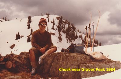
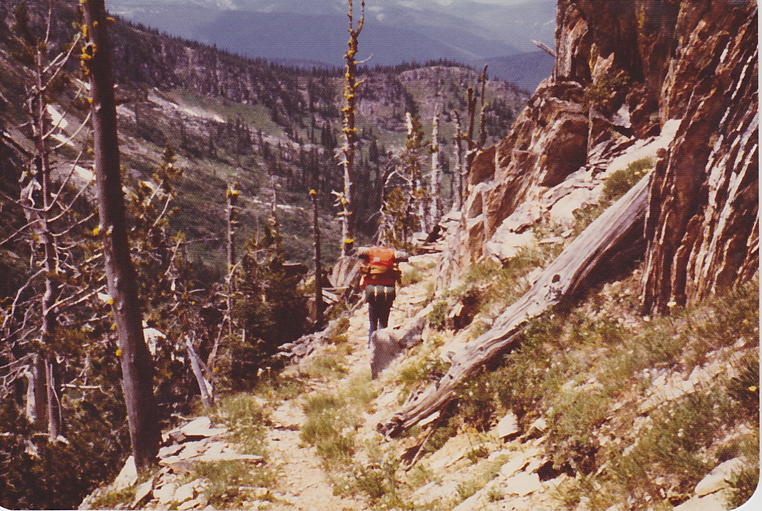
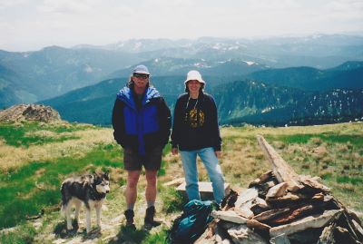
The first time I went to the summit was in 1974 as part of our first camping trip without adults. It was my brother and a couple of his friends and I, we were 14-15 years old. Our parents dropped us off on Freezeout Pass and were to pick us up in Dry Creek in 4 days. There just happened to be some other backpackers there, the picture of the tower has one of the gals leaning out the window.
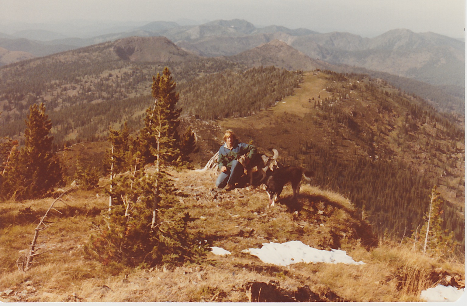
In the summer of 1976 Chuck Bauer and I rode our motorcycles from Hoodoo Pass. We thought it strange that we couldn’t see the tower and as it turns out we were just a day or two behind the tower dismantling. There were a bunch of boxes, assorted gear and some rolled up parachutes scattered across the summit and the tower laid out in sections. As per the time, we had just decided to go for a ride and didn’t have a thing with us, no day packs or cameras. It was not uncommon to just take off for the day with not even a day pack in those days.
 I made several solo attempts in the early 1980’s to complete a winter ascent of the peak from Freezeout Pass. My backcountry ski gear back in those days was not very good and I wasn’t an accomplished skier at all. One try was when the temperature was hovering around 0. Just about frost-bit my toes, it took almost an hour to really thaw them out back at the truck.
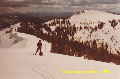
  Another try, found me at the 7,000 ft mark. The final slope to the summit was just like cement from the wind so I decided to bag it as I didn’t think I could make it back down in one piece. Remember, my gear and skills were lacking, and I was skiing solo with no means to send for help. Finally in May of 1984, Chuck Bauer and I skied from the Hoodoo basin to the summit.
In the late 1980’s (1988) when I was working on the Superior district fire crew, I was dropped off on the summit by helicopter along with a gal that was also on the crew. I don’t remember her name, but she was a distance runner at the University of Montana and was from Arlee. We worked a lightning strike down the main ridge a bit for a day or so. The year before, Dave Armstrong and I were dropped off on Graves Peak just a 1/2 mile away and spent a couple days on another lightning strike.
Many years ago, I came across an alidade map for Illinois Peak. This is the circular metal map that the lookout employee used to help locate fires. I believe that it may be the original map from 1938. If it is not, then it is probably a late 1940’s version as the road systems are definitely pre 1950’s. At some point I will most likely give it to the Mineral County or Montana Historical Society, but for the moment it is hanging in the garage.