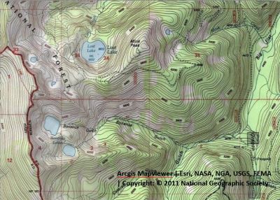
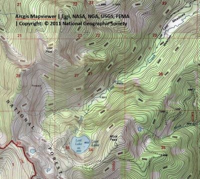
Getting There: This is the most common way in and usually requires some sort of 4-wheeled transportation. From Superior, take Cedar Creek Road #320 and head toward Missoula Lake. After coming off Miller Saddle, (about 20 mi) there will be an intersection at the bottom of the drainage.
Take the right fork (road #7763) with the sign for the Big Flat down the hill. The left fork will take you up to the Oregon Lakes trailhead (1/2 mi); going straight will take you across Oregon Creek and up to the state line (Cascade Pass) and Missoula Lake. 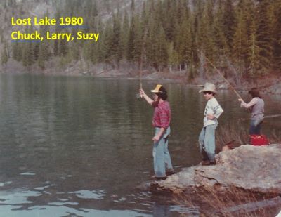 Stay to the left at the 1-mile mark past the private area; another .6 miles will put you at the Bonanza Gulch Trailhead, trail #616, for the Bonanza Lakes.
Continue for another mile and stay left at the intersection and through the open gate; the road is open to all vehicles but generally you should have an all-wheel drive or better with a bit of clearance. The right-hand fork will take you down to the Big Flat area. This used to be open meadows and lots of people camped there but has filled in with vegetation over the years, but there is still lots of camping sites just no meadows.
Back on road #7829; after about 4.5 miles of switchbacks, several small creek crossings and gaining elevation, you will get to an open intersection on top of the ridge. If you don't have a true 4-wheel drive then this is probably the end of the road. Going right up the hill will take you to the top of Mink Peak. There is another primitive road that heads straight towards Lost Lake, it goes downhill a bit before swinging around to the left and reconnecting with the main road. 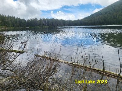 At the end of the open area, the road goes over a couple humps and then heads down the ridge. This is also a rocky primitive road. Follow the primitive road for 1/2 mile then it abruptly turns into a trail. This trail will wind down and around to the lake for about a mile; connecting with the trail coming out of the Lost Creek Meadows along the way.
Getting There: This is a good alternate route if you don’t mind walking a couple more miles and seeing some different country; this is also a shorter drive to the trailhead. From Superior, take Cedar Creek Road #320 and bear right at the bridge and head up Lost Creek Road #7865 for almost 8 miles. The road can be a bit rocky and rough in places and muddy near the end early in the summer. Stay on the main road that hugs the creek bottom until you get to the meadows and a switchback with a gate on the other side.
The trail (#112) takes off at this point (there is a sign). 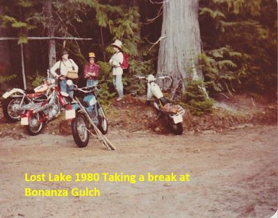 The sign says 5 miles, but it is really 3.75 miles. This is a good trail most of the way with no other side trails to negotiate. The first mile is a gentle path through the woods. You turn up the hill and switchback up and past the falls to a nice meadow and a view of the stateline. The trail continues moderately up the valley and eventually climbs around the basin below the stateline.
You connect with the road/trail from the Big Flat description once you pass across the open basin. The trail climbs a bit steeper here and then the trail takes off to the left. There is a “Trail” sign at the junction. The trail climbs gently around the shoulder of the mountain before dropping into Lost Lake. There is plenty of water available along the way and no major creek crossings that require any wading.
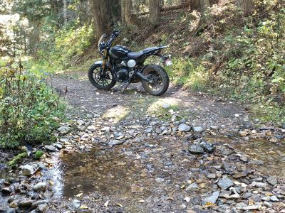
This is a good route early in the summer if the road over Charlie Miller is not yet open. This is also a dandy single track for Mountain Bikes. It is a little steep and technical going past the falls and is rockier as you climb towards the state line, but totally doable with today’s mountain bikes. I rode my motorcycle up to the falls one time when I was a teenager. The trail is no longer open to motorized vehicles.
Getting There: From Superior, take Cedar Creek Road #320 and head toward Missoula Lake and Cascade Pass, a distance of 25 miles; stay on the main road as there are several other roads that connect. After coming off Miller Saddle, (about 20 mi) there will be an intersection at the bottom of the drainage. 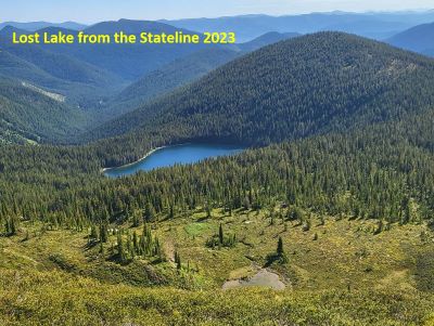 Stay straight crossing Oregon Creek. The right fork at this intersection (road #7763) heads down the hill to the Big Flat; the left fork will take you up to the Oregon Lakes trailhead (1/2 mi).
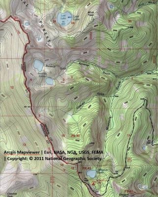
Starting at Cascade Pass (Missoula Lake saddle) take stateline trail #738 towards the Bonanza Lakes. Instead of dropping into the upper reaches of Cataract Gulch and eventually the Bonanza Lakes, continue north on the stateline trail.
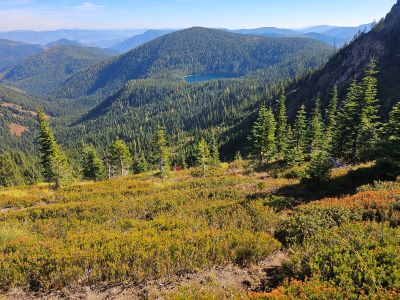
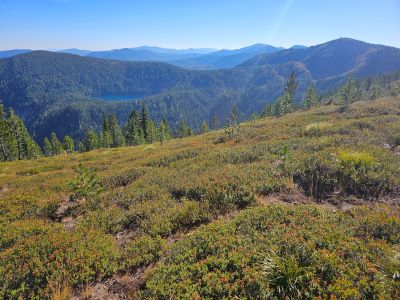
This is a grind as it is mostly uphill until the high point above the Upper Bonanza. This is a dry route until you can find water in the basin going to Lost Lake. From the high point you have Lost Lake to the east, Frog Lake to the west and the Upper Bonanza directly below.
Work your way down the ridge and into the basin on the assorted game trails towards Lost Lake until you intersect the old road from the Big Flat Route, then follow the standard way to the lake. 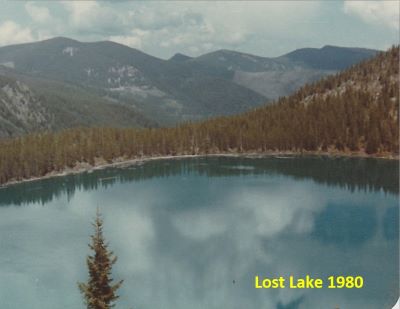 When you leave Lost Lake, you can either return the same way you came in or take this alternate route to the Bonanza Lakes.
Head for the lower shoulder of the main ridge above the Upper Bonanza Lake, make sure you stay above the prominent cliff bands. You can see these prominent bands on Google Earth. There are several game trails to follow. Work your way around the shoulder until the Upper Bonanza Lake comes into view. This is a very steep section of the mountain so take care as any trails will be marginal or no actual game trail may be found. Angle toward the outlet and then the rest of the route is just the standard Bonanza Lakes trail back to Cascade Pass. The entire route is less than 10 miles but most of it is dry outside of the lakes and the trails can be steep and marginal at best.
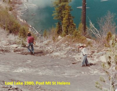
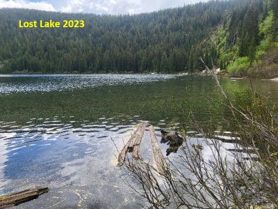
At the Lake: Lost Lake is a large lake for the Great Burn region and contains moderate sized brook trout, so fishing is good. The lake doesn’t get a ton of traffic outside of the motorized crowd, it just doesn’t have the same reputation as the Bonanza’s and some other lakes in the region. There are several campsites scattered along the shoreline. The shoreline can be a bit brushy with Alders in places and difficult to navigate.