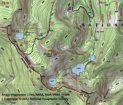
Getting There: I prefer this option as it is the easiest and shortest route to Upper Oregon Lake. From Superior, take Cedar Creek Road #320 and head toward Missoula Lake and Cascade Pass, 25 miles; stay on the main road as there are several other roads that connect. After coming off Miller Saddle, (about 20 mi) there will be an intersection at the bottom of the drainage. Stay straight crossing Oregon Creek. The right fork at this intersection (road #7763) heads down the hill to the Big Flat; the left fork will take you up to the Oregon Lakes trailhead (1/2 mi). 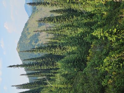 About a mile from the stateline (Cascade Pass) there will be a road dropping off to the right and signage for Missoula Lake and campground. Go past this turnoff for about 2 tenths of a mile where there is a wide spot on the right to park; also at this point is a trail coming out of the Missoula Lake Campground.
There is a marginal unmarked trail starting directly across from this point near a small stream that will wind its way through the scrub trees and eventually makes a steep climb up over the saddle and down to Upper Oregon Lake. Once you cross the small stream about halfway up the basin the trail becomes much better. Take care with your route finding as there are several other false trails that can be followed but do not lead anywhere. The trail gets more defined as you get farther up the hillside from the road. It is less than a mile to the saddle from the road. Once on the saddle head left along the ridge toward the summit; hiking to the summit as best you can. The going is easy with very little brush and deadfall.
Getting There: Another route is to start at Cascade Pass (Missoula Lake Saddle) and head south on the state line trail towards Illinois Peak. From Superior, take Cedar Creek Road #320 and head toward Missoula Lake and Cascade Pass, 25 miles; stay on the main road as there are several other roads that connect. After coming off Miller Saddle, (about 20 mi) there will be an intersection at the bottom of the drainage. Stay straight crossing Oregon Creek. The right fork at this intersection (road #7763) heads down the hill to the Big Flat; the left fork will take you up to the Oregon Lakes trailhead (1/2 mi).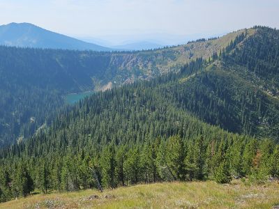 Continue past Missoula Lake to Cascade Pass (Missoula Lake saddle) and take the stateline trail #738 south towards the Illinois Peak. When you get back to the stateline and overlooking the Upper Oregon Lake, leave the trail and work your way back north along the ridge to connect with an obvious trail that traverses the hillside towards Oregon Peak and connects into the trail from Missoula Lake just below the low saddle.
The primitive trail is not great but offers an alternative to the other route. You could also use this route as part of loop from the Missoula Lake route. This route is about twice as far as the route over the low saddle from Missoula Lake. Once on the saddle head along the ridge toward the summit; hiking to the summit as best you can. The going is easy with very little brush and deadfall.
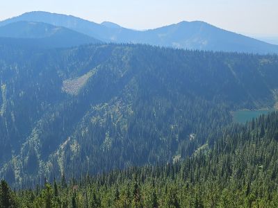
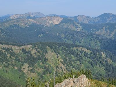
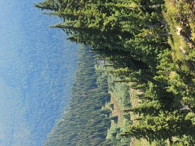
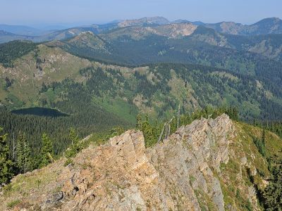
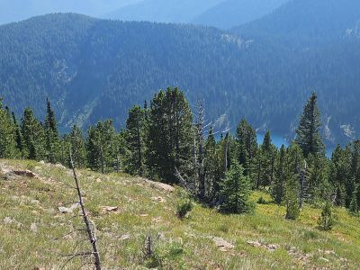
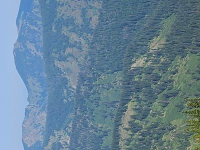
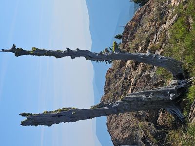
On the Summit: The summit is a sharp grassy knoll with a band of rocks on top. There is no registar or benchmark. The views are good in all directions with North being the best with Missoula Lake in the foreground and Eagle Cliff Peak in the distance. Lost and Binocular Peaks are also part of the view. To the south/west is Illinois Peak and the Upper Oregon Lake. If you go down the rocky north ridge you can see a small lake/pond below the peak. To get a glimpse of the Lower and Middle Oregon Lakes you will need to come off the summit a little bit. To see all 3 Oregon Lakes, you need to go over to the high point across the saddle. It is best to access that from the stateline trail. This is an easy hike/climb to the peak, as I was able to walk out of the campground at 8 and was back before 1 and I also hiked down to the Upper Oregon Lake to have lunch.