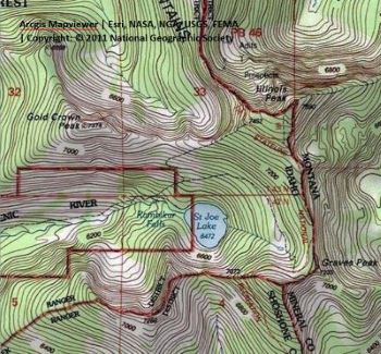
Getting There: From Superior, take Cedar Creek Road #320 and head toward Missoula Lake and Cascade Pass, 25 miles; stay on the main road as there are several other roads that connect. After coming off Miller Saddle, (about 20 mi) there will be an intersection at the bottom of the drainage. Stay straight crossing Oregon Creek. The right fork at this intersection (road #7763) heads down the hill to the Big Flat; the left fork will take you up to the Oregon Lakes trailhead (1/2 mi).
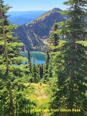
 Continue past Missoula Lake to Cascade Pass (Missoula Lake saddle) and take the state line trail #738 south towards the Illinois Peak for about 3.5 miles to the eastern shoulder of Illinois Peak. Take the unnamed trail to the right heading straight down the ridge towards Gold Crown Peak. This is a steep drop into the lake. The trail connects with trail #49 from the St Joe River just above Rambikur Falls. It is about a mile down to the lake from this high point for a total of 4.75 miles one way. There is no water on this route until you reach the lake.
Getting There: From Superior, take Cedar Creek Road #320 and head toward Missoula Lake and Cascade Pass, 25 miles; stay on the main road as there are several other roads that connect. After coming off Miller Saddle, (about 20 mi) there will be an intersection at the bottom of the drainage. Stay straight crossing Oregon Creek. The right fork at this intersection (road #7763) heads down the hill to the Big Flat; the left fork will take you up to the Oregon Lakes trailhead (1/2 mi). Continue past Missoula Lake to Cascade Pass (Missoula Lake saddle).
 Instead of parking at Cascade Pass, continue over into Idaho for approximately 3.5 miles; this is still road #320. This section of road is not as good as on the Montana side. Even though it is only 3.5 miles it is a slow and rocky go. Take the left fork prior to crossing the bridge over Medicine Creek and a short distance to the trailhead. The trailhead is very well used and has multiple camping and parking spots.
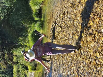
Trail #49 is an old road for about a mile or so and crosses the St Joe River several times in the first couple miles, although the river is just a small creek at this point. I hiked this route in late August and was able to complete all the crossings without getting my feet wet.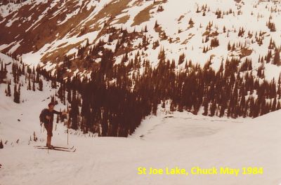 The trail is very easy for the first 2 miles and then starts to climb up the drainage to the lake. The only really steep section is the climb around Rambikur Falls that occurs in the last mile to the lake which is the official headwaters to the St. Joe River.
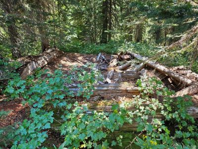
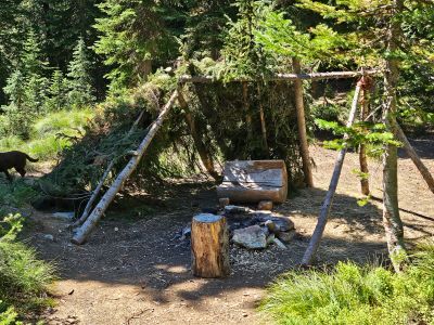
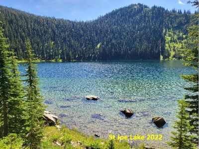
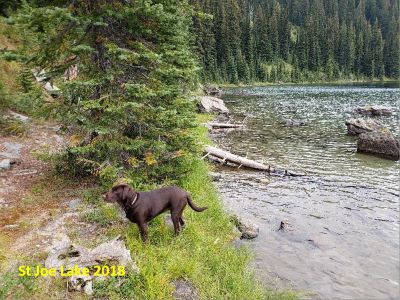
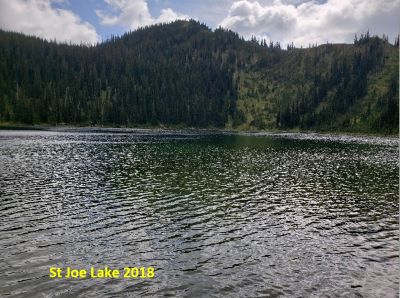
At the Lake: St Joe Lake is of decent size with a walkable shoreline most of the way around the lake. Fishing for Cutthroats can be good at times, but it has been hit and miss for me the couple times I have hiked in. I have not spent the night there, so I have been fishing mid-day rather than early in the morning. There are multiple campsites in and around the outlet area. It looks like 5-7 parties can be accommodated.
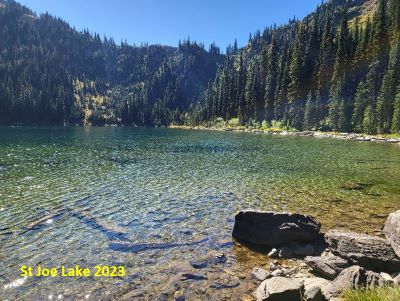 I was kind of surprised at how beat up the camping sites are and that whole area of lake shore is. I didn’t think this lake got that amount of traffic but apparently it does. I have only been there during the week, so I have never seen anyone else at the lake. I have read some excerpts from other sites that it is quite busy on the weekends and campsites can fill up.
Other Route Options: You may also come along the state line trail from Hoodoo Pass via Rawhide Road; that route is about 6 miles in length. You can also come from Freezeout Pass and climb directly over Illinois Peak and down to Saint Joe Lake. This is the hardest route by far. The only reliable water on the state line between Cascade Pass and Rawhide Road near Hoodoo Pass in the summer months is the small basin between Illinois and Graves Peaks, so plan accordingly.
I have seen parties do a shuttle from Cascade Pass to the St. Joe River Trailhead and then complete a point-to-point hike of approximately 10 miles. A good adventure would be to visit Graves, Illinois, and Gold Crown peaks in a day. There is a marginal and brushy trail to the low notch on the south side of the lake. From there climb the ridges to Graves Peak, then Illinois and Gold Crown. Returning to the lake to close the loop. I have not completed this but read a description of it.