Getting There: At Superior, take Diamond Road east past the Town Pump Gas Station for 6 miles; passing the Bark mill and the Magone Ranches to the end of the pavement where the road changes to Trout Creek Road (#250). Continue up Trout Creek Road for 12 miles and turn right on Road #7813 for 2 miles.  Take a left at the 4th switchback down the hill on Road #388 for 1 mile to the end of the road and trailhead.
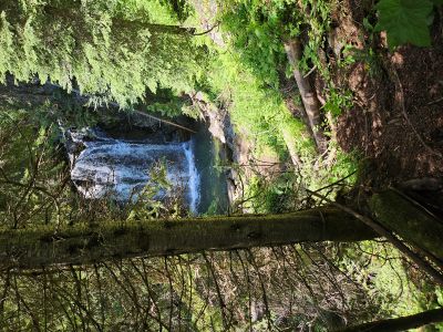
The trail #156 starts as an old road that was drivable by a regular pickup truck when I was growing up. There are a couple of small crossings along the trail. The trail climbs moderately for a little over a mile until the old road ends and becomes a single track. Look for a primitive steep trail that heads down to a set of falls not too far into the hike, not far past the 2nd switchback. It is quite the climb down to the falls; there are 20 foot ropes to help get down to the falls. It would be difficult to get down the trail without them.
The trail then climbs more steeply for the next mile or so with several switchbacks intermixed with some nice level stretches. The last 1/4 mile to the lake after the final creek crossing are the steepest part of the hike. There is plenty of water available for your dog along the trail and the trail is very family friendly.
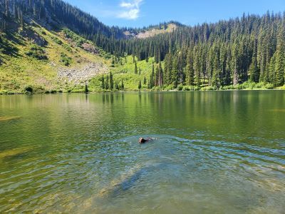
At the Lake: Fishing at the lake consists of Brook Trout and historically it has been good fishing. The shoreline is very brushy and there are large areas of logs that block casting and are too waterlogged to walk out on. I would suggest a small raft is a must to really fish the entire lake.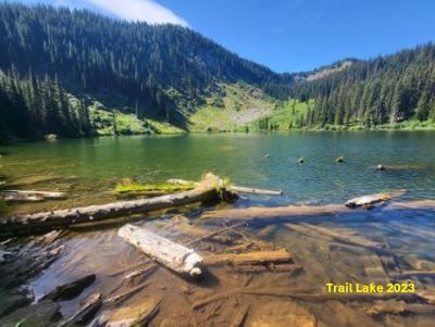 There used to be several handmade log rafts available at the lake, but the logs used for them have rotted away over the years and I didn’t see any the last time I visited the lake.
There are several large campsites around the outlet. It is an easy hike in, so it does get some large parties that leave significant impact. The map indicates that you can access Trail Lake from the state line trail, but I have never hiked that route before. I understand it to be in poor condition, but there is a trail project in 2025 to refresh the tread and brush out the trail. This project was partially completed in 2025. The first time I went into the lake was with the Boy Scouts when I was 11 or 12.
Chuck & Steve Bauer and I skied into the lake one winter day in the early 80’s. If you hit this lake at the right time late in the summer Huckleberry’s are prominent along the trail and mellow sidehills towards the outlet stream. I fished from the main Trout Creek (bridge) to the trailhead when I was in my teens. It was a brushy and sometimes a hard climb up the creek, but I did well that day.