Home
The Lakes
Thompson & Cooper Pass Area
Lookout Pass Area
St Regis & Ward Peak Area
Superior - Dry & Cedar Creek Area
Superior - Trout Creek Area
Fish Creek - Clearwater Crossing Area
Fish Creek - Schley Mountain Area
By Category
Outside The Burn
Stateline Trail 738
Dry Creek => Cedar Creek
Cedar Creek => Hoodoo Pass
Hoodoo Pass => Goose Lake
Goose Lake => Fish Lake
Fish Lake => Schley Mtn
Schley Mtn => Cache Creek
Weekly Reports
Weekly Reports 2024
Weekly Reports 2025
Weekly Reports 2026
Everything Else
Liability Release
Alerts
Route Difficulty
Links
Bruce's Gear Stash
What About Bruce
& More
Anaconda-Pintler Wilderness
Arches N.P.
Bryce Canyon N.P.
Canyonlands N.P.
Glacier N.P.
Natural Bridges N.M.
Email Me
☰
Site under development and will continue to change.
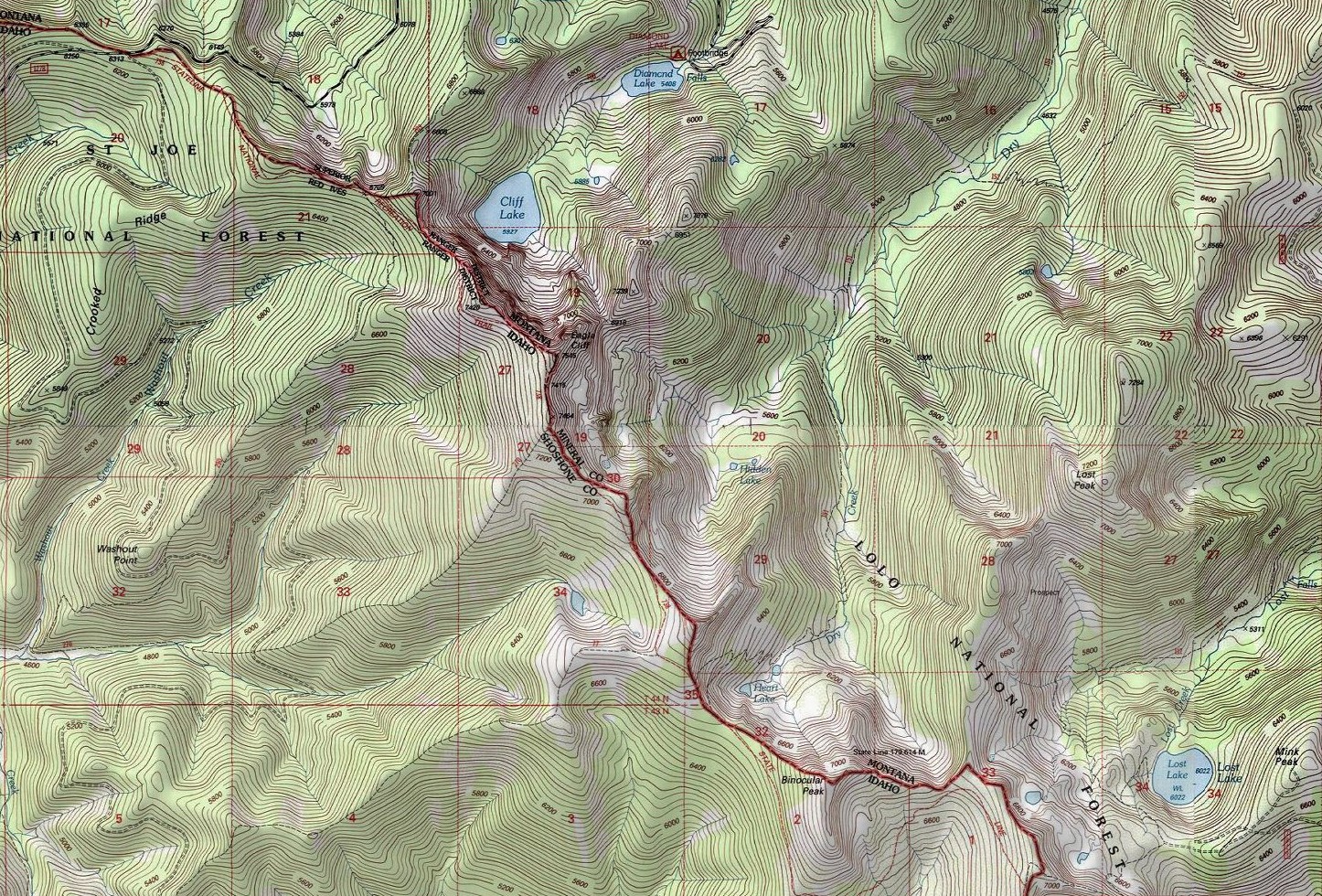
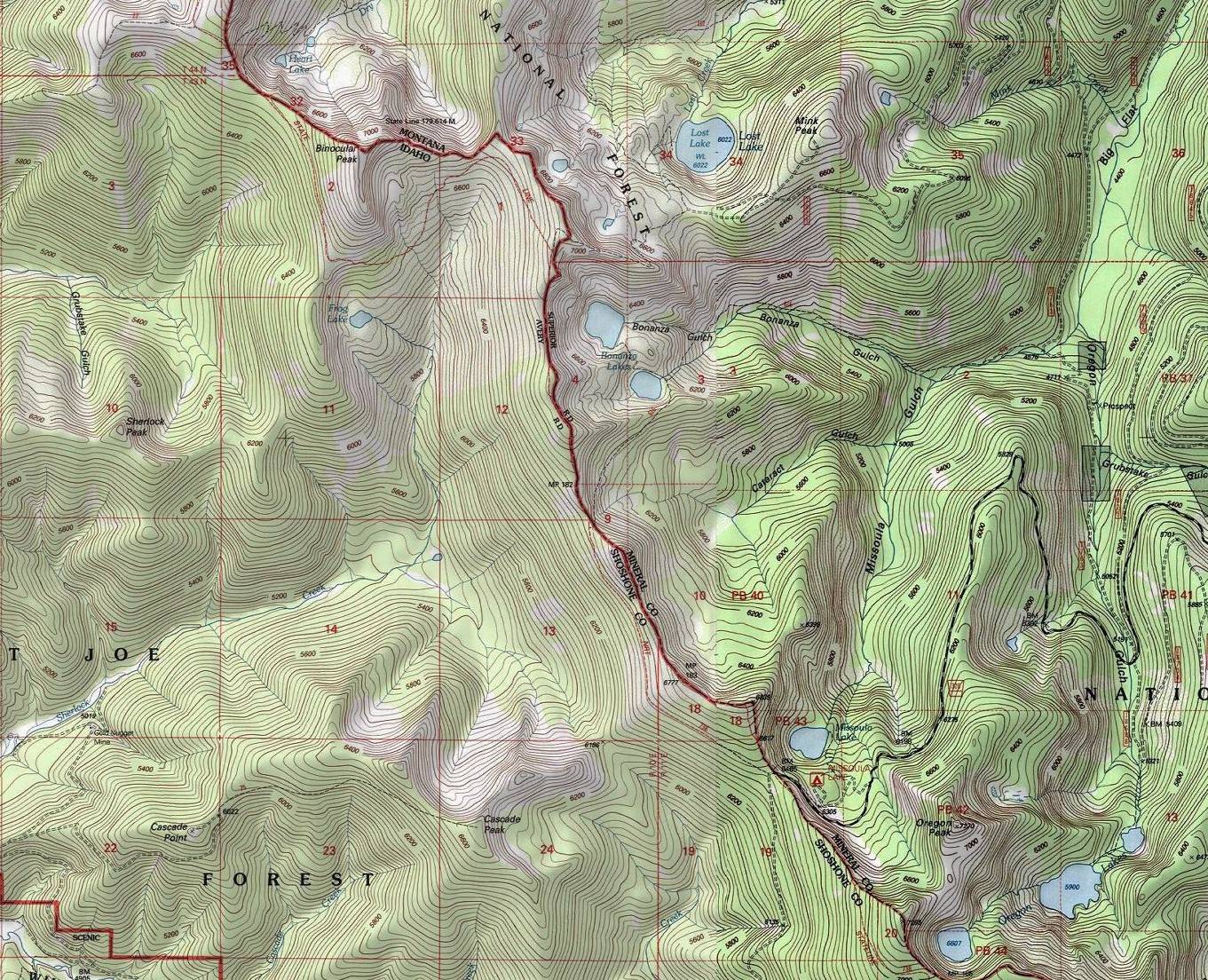
Dry Creek to Cascade Pass Topographic Maps
Arcgis Mapviewer | Esri, NASA, NGA, USGS, FEMA | Copyright: © 2011 National Geographic Society
© 2024-2026 GreatBurnLakes. All rights reserved.