Getting There: Take the exit atop Lookout Pass and head to the ski area. Hang a hard left, almost a U-turn, near the maintenance area on the old Northern Pacific Railroad grade. Head down the grade for about a mile and then hang a right on the road (#18591) that accesses the bottom of chair 2 and the Eagle Peak expansion. You may also take the old US 10 highway that takes off directly down and away from the interchange, but you will have to climb up a marginal road to get to the railroad grade and the chair 2 and Eagle Peak access road.  If in a car, this is the place (chair 2) to stop.
If not, then continue up the access road for 1/4 mile and bear left on the old road to the creek crossing. In 2024, Lookout Pass appears to be installing at gate at this junction to block access to the Eagle Peak expansion. Bear to the right after crossing the creek and continue for another half mile to the trailhead. The trailhead parking is very limited, just a couple vehicles if people park with some consideration. There are also places along the way to park and add a bit of distance to your hike.
The trail (#267) starts at the parking area, there is also a small place to camp, and goes about a hundred yards where you angle down to the right and cross the outlet stream coming out of the St. Regis Lakes. This early part of the trail is accessed by SxS and bikes until the creek crossing, then heads up toward the state line.
Trail #267 crosses the creek then moderately climbs across the hillside for about a mile and crosses the creek again. The trail continues to climb moderately; there are 8 switchbacks to climb the final 450+ feet of elevation to the Lower St Regis Lake after the 2nd creek crossing. Once at the Lower St. Regis Lake, follow the shoreline trail around on the right side, the trail is good and angles down to the upper lake. It is less than a 1/3 mile to the Upper St. Regis Lake.
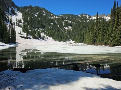
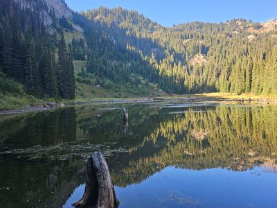
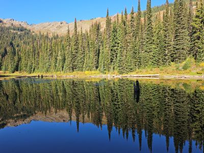
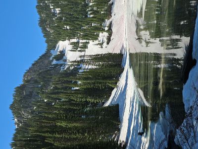
At the Lake: The upper lake is essentially a pond with no fish and lots of bugs. The lake is called the “Upper” lake but in all actuality is about 30 feet lower than the main lake, according to Google Earth. There are several campsites in the trees here, which appear to be mainly overflow from the other lake.