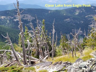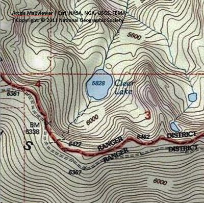
Getting There: The best route to get to the trailhead is to take the Little Joe Road (#282) out of St. Regis and then take the state line road (#391) at the summit. The unmarked trailhead is about 7.5 miles along the stateline road #391 from the Little Joe Road at a low saddle with parking and camping available.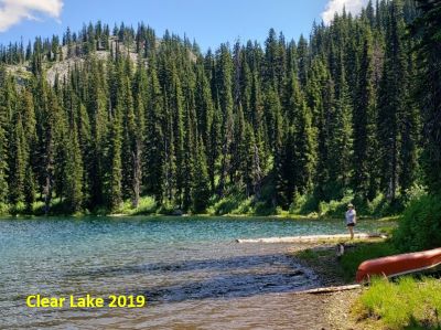 The unsigned trailhead is right on the stateline, and you can see the lake from there. I have seen cars on this part of the road, but a higher clearance vehicle is preferable.
The trail (#1260) down into the lake is one of the steepest drops into any of the lakes along the state line. The distance to the lake is only 1/3 to 1/2 mile, but the first couple hundred yards are tricky going down and brutal coming back up. Along with being very steep, the trail is very primitive. The lower portion of the trail is not bad as it becomes more defined and less of a pitch.
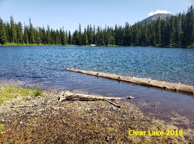
At the Lake: The last and only time I have been to this lake there was a canoe sitting along the shoreline. Quite a feat to get that down from the trailhead. There are several camping sites around the lake and the shoreline is easy to get around. The fishing was poor with little more than 6-inch trout available.
The day my wife Kathy and I were there, a moose was hanging around the far shore for most of the time we were there. The lake is shallow near the shore, so it is easy to wade out for fly casting. The shoreline itself was mostly free of any brush and easy walking.