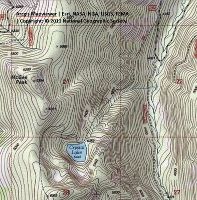
Getting There: Take the De Borgia exit and head up Deer Creek Road #236 south of the interstate for approximately 6 miles until you come to a closed gate just few hundred yards from the bridge crossing Deer Creek. Stay on the main road, it can be a bit rough the further up you go but is car passable. The trailhead has room for 5-6 vehicles if parked courteously. The trailhead is un-signed, but the trail is easily found.
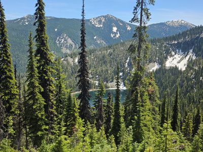
The trail (#269) itself is an old mining road that consistently climbs at a good grade all the way to the lake. It is only about 1.5 miles to Crystal Lake, but it is about 1300 feet of elevation gain over that distance. There are a couple points along the trail for water access for your dog, so no need to carry extra water. Earlier in the year some upper parts of the trail are basically a stream, but not really that slick.
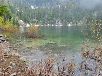
At the Lake: There are several places to pitch a tent on either side of the outlet, but the right side is very minimal. There is also an outhouse to the left up in the trees. There are some small trout in the lake, but generally the fishing is poor. The shoreline is easy to get around and there is an old mine shaft on the far side of the lake. It is actually very good swimming at the lake. In 2021, there were ripe huckleberries at the trailhead, green at the halfway point and still in blossom at the lake. The lake does get a bit of traffic, like many the lakes along the stateline.
From the lake, the trail does cross the outlet and then continues up the hill. This will take you past the primitive trail to Rudie Lake and eventually ends on the state line road (#391) in a little over 2 miles. This is a nice day hike if camping for a couple days at Crystal Lake.