
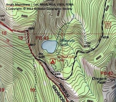
Getting There: From Superior, take Cedar Creek Road #320 and head toward Missoula Lake and Cascade Pass, 25 miles; stay on the main road as there are several other roads that connect. After coming off Miller Saddle, (about 20 mi) there will l be an intersection at the bottom of the drainage. Stay straight crossing Oregon Creek. The right fork at this intersection (road #7763) heads down the hill to the Big Flat; the left fork will take you up to the Oregon Lakes trailhead (1/2 mi).
About a mile from the state line (Cascade Pass) there will be a road dropping off to the right and signage for Missoula Lake and campground. 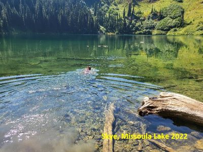 A couple hundred yards down this road will be the first of 3 different trailheads, you can park there, and the lake is an easy 0.35-mile stroll down the hill. The second trailhead is at the far end of Forest Service Campground and there is signage. This trail connects into the first trailhead trail and continues to the lake coming in at the lake’s outlet. The third trailhead is just to the left of the second. It takes off through the far-left campsite and goes straight down the hill and accesses the far side of the lake near the inlet. This is a steep climb in and out.
At the Lake: Missoula Lake is of average size and generally warm enough to enjoy a good swim. Fishing can be hit or miss; remember the stocking schedules. There are many times over the years that I got skunked but sometimes it can be great. In 2023, I wandered down one evening and caught three 14 in plus trout in just a couple minutes. People bring pontoon boats and kayaks in, and it does get significant fishing pressure.
 There are a couple of small campsites near the outlet but in general people don’t camp there very often. There is no trail around the entire lake; you need to take the 3rd trailhead down to access the far side or do a lot of bushwacking around the lake to get there. I always find it interesting that many lakes that have lots of traffic do not have a trail around the lake, whereas a remote lake like Crater Lake has a trail around it.
The campground above the lake itself is nice, although no water is available. There are about 10 sites available and 1 vault toilet services the campground; that can get rank if users are slobs. About half the sites will accommodate up to a 24-foot trailer.
In 2022 we saw a 30+ foot trailer come through. I was surprised as the pull over Charlie Miller Saddle has 3 tight switchbacks and the road from Rabbit Creek is very narrow and steep in places; on our way out, you could see that they had to ride up the embankments (both truck & trailer) just to get around them.  The switchbacks have been improved to accommodate the logging traffic the past couple years. Notwithstanding there are very few places in the 20+ miles from Superior that will accommodate over 50 feet of truck and trailer for passing.
Outside of the official campground, there are several places to camp near the 1st described trailhead along the road. There is also lots of room on Cascade Pass itself, although I have never found the pass a good option during the summer lightning storms.